Showers and isol'd t-storms today. Strong to severe storms possible Mon. afternoon/eve. Highs in 60s today. #inwx pic.twitter.com/sq37PPZFPP
— NWS Indianapolis (@NWSIndianapolis) March 26, 2017
“Showers and isolated t-storms today. Strong to severe storms possible Monday afternoon and evening. Highs in 60s today.”
On this date in 1948: an F4 tornado tracks from near Brazil/Clay Co to Danville/Hendricks Co, w/ 20 fatalities & 200 injuries. #INwx #indy
— NWS Indianapolis (@NWSIndianapolis) March 26, 2017
“On this date in 1948: F4 tornado tracks from near Brazil/Clay County to Danville/Hendricks County, with 20 fatalities & 200 injuries.”
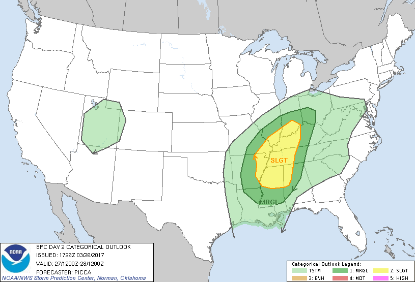
Slight Chance of Severe Thunderstorms over South Central Indiana Monday. Stay alert for updates! https://t.co/j236ZiRes3
— NWS Indianapolis (@NWSIndianapolis) March 26, 2017
“Slight Chance of Severe Thunderstorms over South Central Indiana Monday. Stay alert for updates!”
Via NWS Indianapolis. Follow them on Twitter @NWSIndianapolis for the latest Indianapolis area weather news.