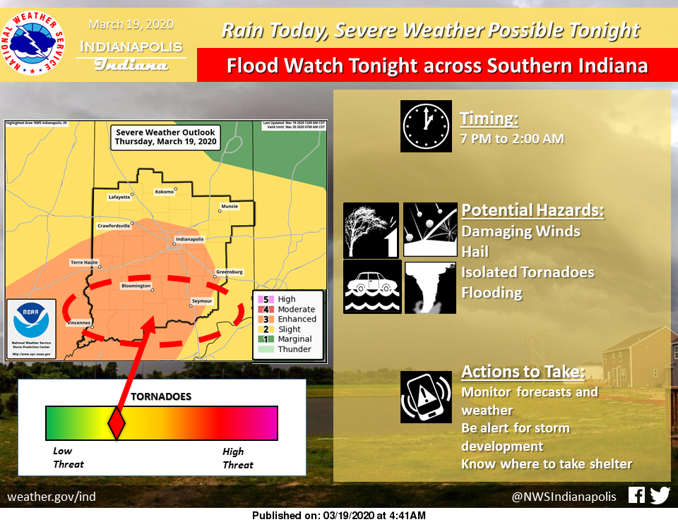
Look for rain to arrive today with chances for Severe thunderstorms tonight.
There is an ENHANCED RISK for Severe weather across much of Central Indiana today and tonight.
The primary threats are damaging winds, hail, isolated tornadoes, and flooding.
The expected timing is 7:00 PM to 2:00 AM.
Via NWS Indianapolis. Follow them on Twitter @NWSIndianapolis for the latest Indianapolis area weather news.
AROUND TWITTER
Here is our latest weather briefing discussing the ENHNACED RISK for severe weather across Central Indiana today. #inwxhttps://t.co/FTPXhah2fP
— NWS Indianapolis (@NWSIndianapolis) March 19, 2020
Thunderstorms can produce deadly lightning capable of striking up to 10 miles away from a storm — so, even if you don't see rain you could be in harm's way. Remember this simple message: When Thunder Roars, Go Indoors! https://t.co/cQWAuc0fjV pic.twitter.com/ColGIagkXH
— NWS Indianapolis (@NWSIndianapolis) March 19, 2020
Strong to severe storms possible in central Indiana after 6pm tonight. Please be weather aware! @WTHRcom #INwx pic.twitter.com/dhdM6D3GqJ
— Kelly Greene (@kellygreenewx) March 19, 2020
The sun is up! Here's what's ahead in our Thursday forecast. #INwx pic.twitter.com/QizRXqPECE
— Kyle Mounce (@kylemounce) March 19, 2020