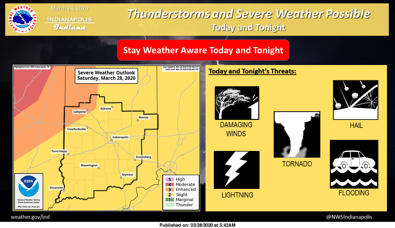
Severe storms are possible today and tonight. Storms are most likely this afternoon and evening.
All severe weather threats are on the table including damaging winds, isolated tornadoes, large hail, and heavy rain all possible.
Have a way to receive warning information, review your safety plan, and be weather aware today!
Via NWS Indianapolis. Follow them on Twitter @NWSIndianapolis for the latest Indianapolis area weather news.
AROUND TWITTER
Heads up in eastern Iowa & northwest Illinois this afternoon/eve. Tornadoes and large hail possible.
Note what forecaster said about long tracked tornadoes. “any tornadoes that do form may persist for nearly as many miles as minutes of time”#ILwx | #IAwx | #INwx pic.twitter.com/a204WMXsYI
— John Dissauer (@johndissauer) March 28, 2020
Severe storms are possible today. Here's the latest severe risk outlook for Central Indiana. @rtv6 #INwx pic.twitter.com/tMBr4rIdXg
— Kyle Mounce (@kylemounce) March 28, 2020
24 Hour Rainfall Totals (Collected at 8:30 AM) >> Heavy rain fell in our northern counties within the last couple hours. Totals below show amounts within the last 24 hours. Includes the waves of rain overnight too… #INwx @FOX59 @theWXauthority #FOX59morning pic.twitter.com/v74Qe02YIG
— Amber Hardwick (@AHardwickWx) March 28, 2020
A warm, breezy and (at times) stormy day ahead. @rtv6 #INwx pic.twitter.com/RY48dhPG3U
— Kyle Mounce (@kylemounce) March 28, 2020