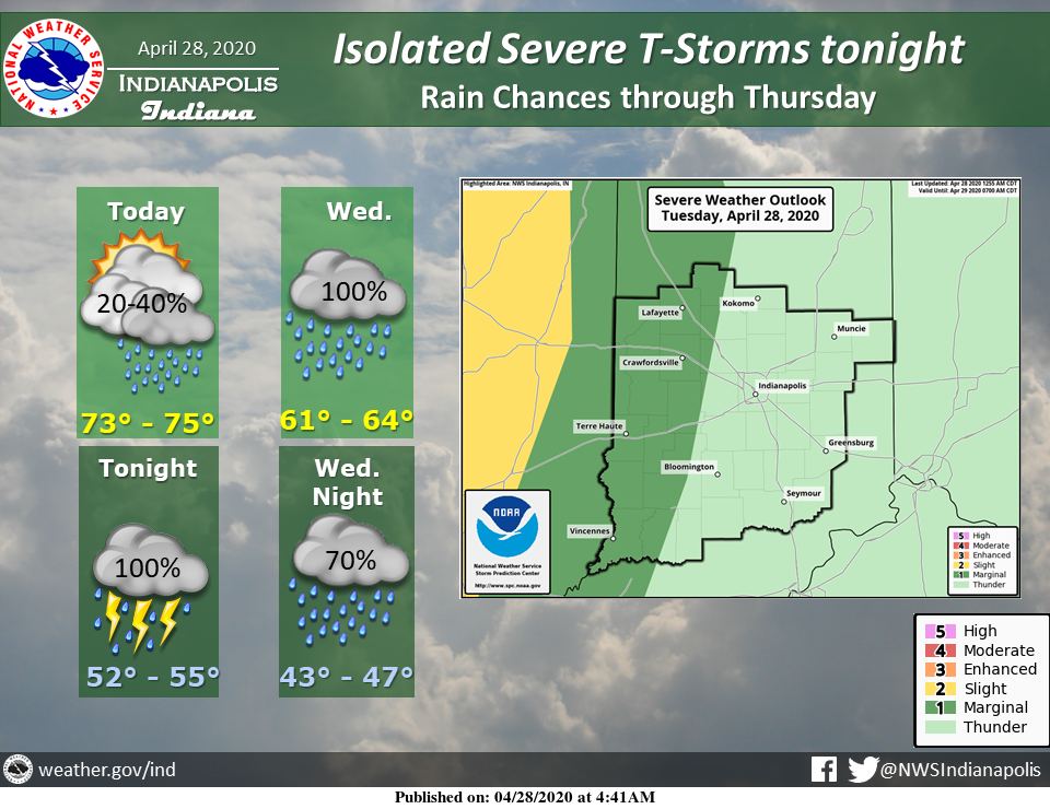
A strong low-pressure system will bring in unsettled weather into Thursday.
A few strong or severe thunderstorms are possible tonight over the western third of central Indiana.
Temperatures this afternoon will be well above normal in the middle 70s.
Via NWS Indianapolis. Follow them on Twitter @NWSIndianapolis for the latest Indianapolis area weather news.
AROUND TWITTER
It's going to be another great afternoon with plenty of sunshine and highs in the mid-70s! Rain and storm chances return later this evening and overnight as a stronger cold front comes through the state. https://t.co/VvKka2yuMN #INwx #FOX59Morning
— FOX59 News (@FOX59) April 28, 2020
Our Tuesday is just getting started. I wanted to share the forecast as you get your day going. #INwx pic.twitter.com/CLKWfEoDTD
— Kyle Mounce (@kylemounce) April 28, 2020
Amber's #Doodlecast >> Today is #NationalSuperHeroDay ! A great reminder that not all super heroes wear capes! A big thank you to ALL first responders! Few AM showers are possible. Breezy with a mix of sun and clouds. High: 75° @fox59 @thewxauthority #FOX59morning #INwx ❤️🚑🚓🚒 pic.twitter.com/i7acJQIzQE
— Amber Hardwick (@AHardwickWx) April 28, 2020
https://twitter.com/StarDerryWX/status/1255066051009806336
A few light showers are possible this morning, with PLENTY of dry time today. Mostly cloudy skies this afternoon with highs in the low to mid 70s! Isolated severe storms arrive mid evening for western Indiana. Line will weaken traveling across the state. @WISH_TV #INwx #Indy pic.twitter.com/JGp8PsA9Ye
— Stephanie Mead (@stephmeadwx) April 28, 2020