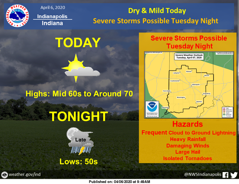
Dry and mild conditions can be expected today. Highs will reach the mid-60s to around 70.
Thunderstorms are possible tonight, with isolated strong storms possible far north.
Severe storms are possible Tuesday night, with all hazards possible.
Via NWS Indianapolis. Follow them on Twitter @NWSIndianapolis for the latest Indianapolis area weather news.
AROUND TWITTER
We're starting the workweek with sunshine and highs in the mid-60s! Even warmer weather is on the way tomorrow. We'll see rain the next two nights, and the round that moves in Tuesday could bring severe weather. https://t.co/IAgnpkEGhz #INwx #FOX59Morning
— FOX59 News (@FOX59) April 6, 2020
It's the start of another work week! Here's a check of your Monday forecast. #INwx pic.twitter.com/H6rsGH3Cm4
— Kyle Mounce (@kylemounce) April 6, 2020
Amber's #Doodlecast >> Pleasant and warmer today! Skies will be partly sunny. High: 66° You have another opportunity to get some yard work done before storm chances rise tonight! @fox59 @cbs4indy #INwx #sketchforecast pic.twitter.com/ohojzz4Di3
— Amber Hardwick (@AHardwickWx) April 6, 2020
A great start to the work week with highs in the upper 60s to near 70°! Storms move in overnight and will be very spotty. @WISH_TV #Indy #INwx pic.twitter.com/1al0U5dx3f
— Stephanie Mead (@stephmeadwx) April 6, 2020