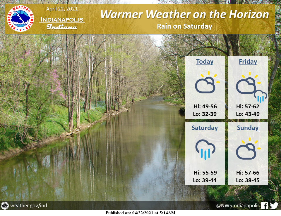
Dry and gradually warmer weather is expected today and Friday.
A few showers are possible over western portions of central Indiana late Friday afternoon with more widespread rain expected late Friday night and Saturday.
Dry weather will return Sunday into early next week with much warmer temperatures by Monday and Tuesday.
INDIANAPOLIS 7-DAY EXTENDED FORECAST
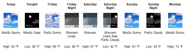
Today: Mostly sunny, with a high near 53. West wind 7 to 13 mph, with gusts as high as 21 mph.
Tonight: Mostly clear, with a low around 36. South southwest wind 5 to 8 mph.
Friday: Partly sunny, with a high near 60. South southwest wind 6 to 11 mph.
Friday Night: Showers likely, mainly after 2 am. Mostly cloudy, with a low around 48. South southeast wind around 8 mph. The chance of precipitation is 60%. New precipitation amounts between a tenth and quarter of an inch possible.
Saturday: Showers. High near 57. Southeast wind 3 to 8 mph. The chance of precipitation is 80%. New precipitation amounts between a quarter and half of an inch possible.
Saturday Night: Showers likely before 8 pm. Mostly cloudy, with a low around 42. The chance of precipitation is 60%. New precipitation amounts of less than a tenth of an inch possible.
Sunday: Mostly sunny, with a high near 61.
Sunday Night: Partly cloudy, with a low around 43.
Monday: Mostly sunny, with a high near 73.
Monday Night: Mostly clear, with a low around 57.
Tuesday: Mostly sunny, with a high near 81.
Tuesday Night: A 40 percent chance of showers. Mostly cloudy, with a low around 62.
Wednesday: Showers and thunderstorms likely. Mostly cloudy, with a high near 77. The chance of precipitation is 60%.
AROUND THE UNITED STATES OF AMERICA


SOURCE: NWS Indianapolis.
Follow NWS Indianapolis on Twitter @NWSIndianapolis for the latest Indianapolis area weather news.