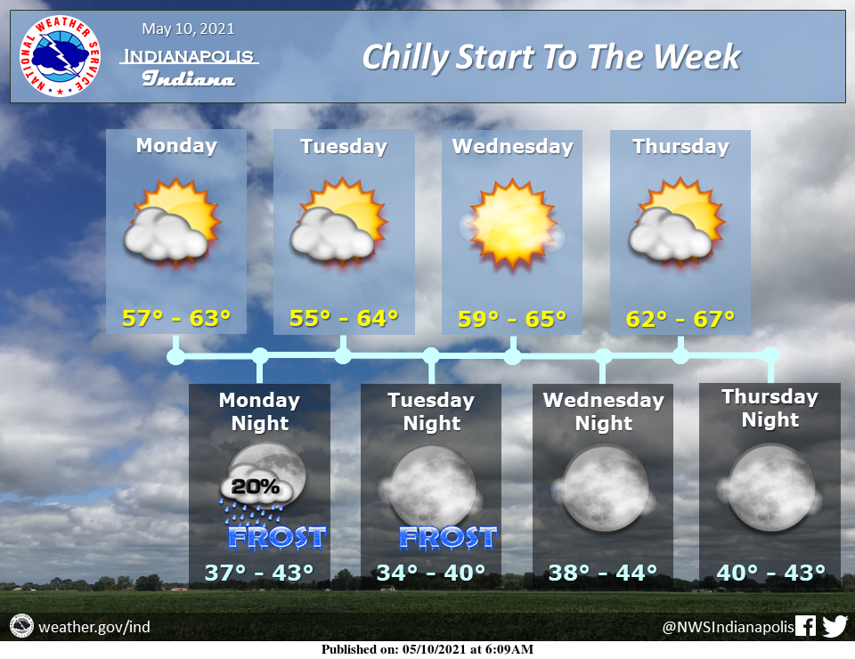
The new week begins on a chilly note with frost this morning and likely the next two nights as well.
Dry weather is expected save for a slight chance of a stray shower tonight.
Temperatures will gradually warm later in the week.
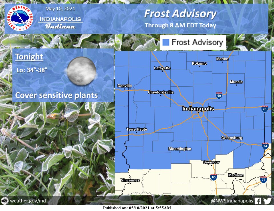
Lows this morning in the mid-30s across much of the area will produce at least patchy frost.
Make sure to cover any sensitive plants, especially with the potential for additional frost the next two nights.
INDIANAPOLIS 7-DAY EXTENDED FORECAST
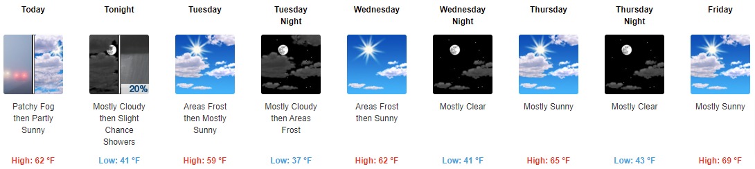
Today: Patchy fog before 9 am. Otherwise, increasing clouds, with a high near 62. Calm wind becoming northwest around 5 mph in the afternoon.
Tonight: A 20 percent chance of showers after 1 am. Mostly cloudy, with a low around 41. North northeast wind 3 to 6 mph.
Tuesday: Areas of frost before 8 am. Otherwise, mostly sunny, with a high near 59. North northeast wind 6 to 10 mph.
Tuesday Night: Areas of frost after 5 am. Otherwise, partly cloudy, with a low around 37. North wind 5 to 9 mph.
Wednesday: Areas of frost before 7 am. Otherwise, sunny, with a high near 62. Northeast wind 3 to 8 mph.
Wednesday Night: Mostly clear, with a low around 41.
Thursday: Mostly sunny, with a high near 65.
Thursday Night: Mostly clear, with a low around 43.
Friday: Mostly sunny, with a high near 69.
Friday Night: Mostly cloudy, with a low around 49.
Saturday: A 40 percent chance of showers. Partly sunny, with a high near 70.
Saturday Night: A 40 percent chance of showers. Mostly cloudy, with a low around 52.
Sunday: A 30 percent chance of showers. Mostly sunny, with a high near 74.
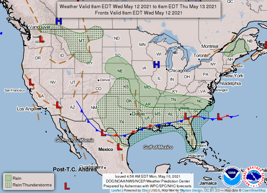
THE UNITED STATES OF AMERICA 3-DAY OUTLOOK


SOURCE: NWS Indianapolis.
Follow NWS Indianapolis on Twitter @NWSIndianapolis for the latest Indianapolis area weather news.