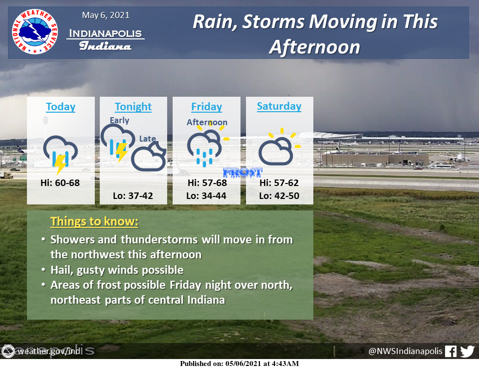
Showers and thunderstorms will move into central Indiana from the northwest this afternoon.
Hail, gusty winds, and cloud-to-ground lightning are possible with these storms.
Showers and storms will move out by midnight.
Friday there will be a chance for showers in the afternoon, but then high pressure will bring in colder temperatures and some frost potential late Friday night into early Saturday morning.
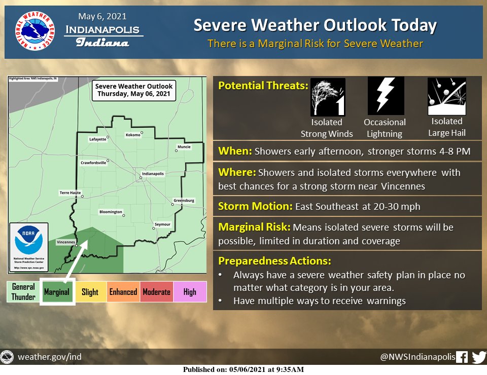
The initial round of showers around noon today with a second round of showers and storms late this afternoon and evening.
Stronger showers and storms will likely produce small hail with the best chance for larger hail or damaging winds across southwest Indiana.
INDIANAPOLIS 7-DAY EXTENDED FORECAST

Today: A chance of showers before 2 pm, then a chance of showers and thunderstorms between 2 pm and 4 pm, then showers likely, and possibly a thunderstorm after 4 pm. Mostly cloudy, with a high near 63. Southwest wind 5 to 15 mph, with gusts as high as 22 mph. The chance of precipitation is 60%. New rainfall amounts between a tenth and quarter of an inch, except higher amounts possible in thunderstorms.
Tonight: Showers and thunderstorms likely before midnight, then a slight chance of showers between midnight and 2 am. Cloudy, then gradually becoming partly cloudy, with a low around 38. Northwest wind 7 to 13 mph, with gusts as high as 20 mph. The chance of precipitation is 60%. New precipitation amounts of less than a tenth of an inch, except higher amounts possible in thunderstorms.
Friday: A 30 percent chance of showers afternoon. Mostly sunny, with a high near 62. West wind 5 to 14 mph, with gusts as high as 24 mph.
Friday Night: Mostly clear, with a low around 38. North northwest wind 5 to 9 mph becoming light north after midnight.
Saturday: Mostly sunny, with a high near 61. Light and variable wind becoming north northeast around 5 mph.
Saturday Night: Showers, mainly after 2 am. Low around 46. The chance of precipitation is 80%. New precipitation amounts between a quarter and half of an inch possible.
Sunday: Showers, with thunderstorms also possible after 2 pm. High near 56. The chance of precipitation is 90%.
Sunday Night: Showers likely and possibly a thunderstorm before 2 am, then a chance of showers. Mostly cloudy, with a low around 44. The chance of precipitation is 60%.
Monday: A 30 percent chance of showers before 8 am. Partly sunny, with a high near 59.
Monday Night: Mostly cloudy, with a low around 40.
Tuesday: Mostly sunny, with a high near 63.
Tuesday Night: Partly cloudy, with a low around 43.
Wednesday: A 20 percent chance of showers. Mostly sunny, with a high near 64.
THE UNITED STATES OF AMERICA 3-DAY OUTLOOK


SOURCE: NWS Indianapolis.
Follow NWS Indianapolis on Twitter @NWSIndianapolis for the latest Indianapolis area weather news.