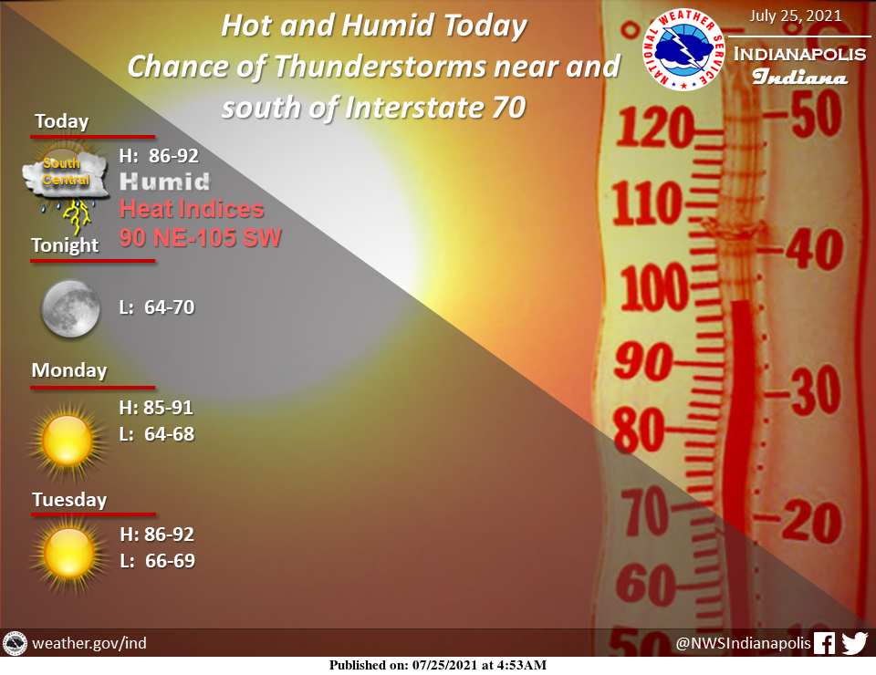
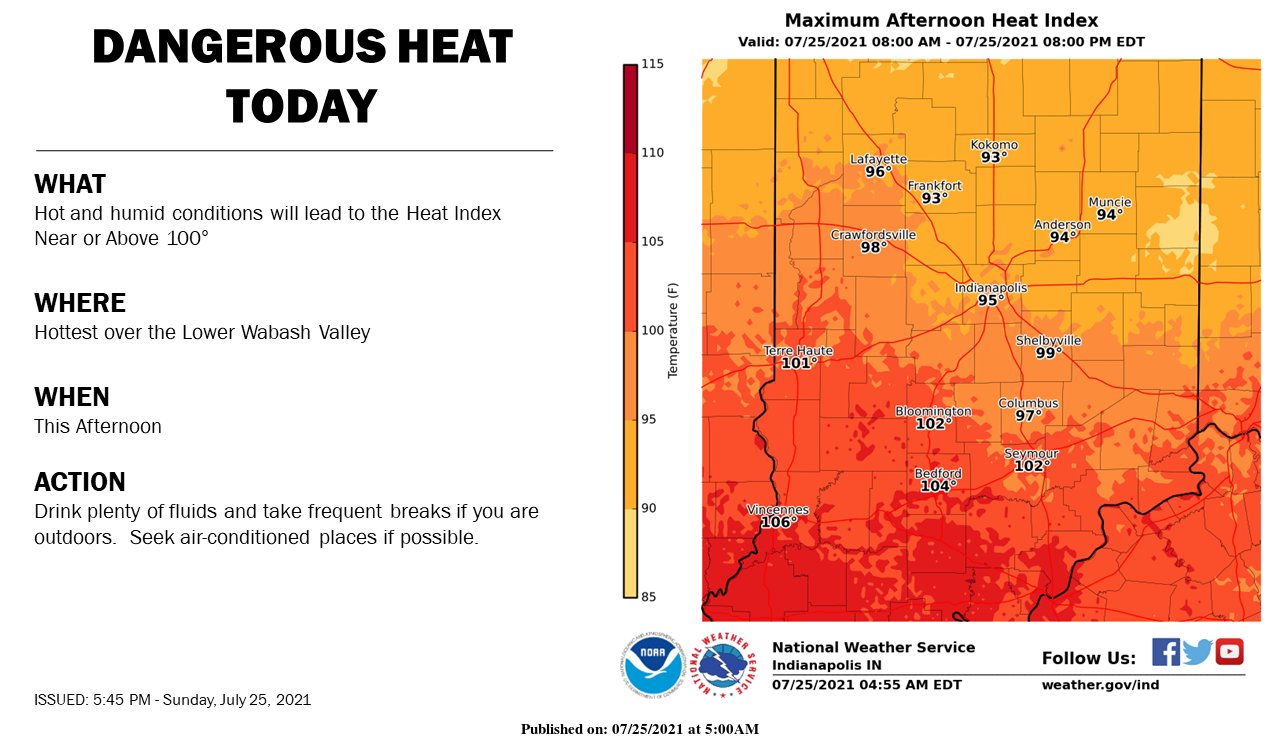
A hot and humid day is in store today, especially over south-central sections where the Heat Index could exceed 100 degrees today at times.
Otherwise, there will remain a chance of thunderstorms near and south of Interstate 70.
Cloud to ground lightning, gusty winds, brief heavy rain, and localized flooding are possible.
Stay hydrated and weather-aware!
INDIANAPOLIS 7-DAY EXTENDED FORECAST
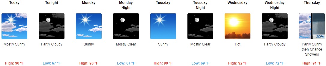
Today: Mostly sunny, with a high near 90. Northwest wind 5 to 7 mph.
Tonight: Partly cloudy, with a low around 67. North wind 5 to 7 mph becoming calm in the evening.
Monday: Sunny, with a high near 90. Calm wind becoming north northeast around 6 mph in the afternoon.
Monday Night: Mostly clear, with a low around 67. Northeast wind around 5 mph becoming calm in the evening.
Tuesday: Sunny, with a high near 90. Calm wind.
Tuesday Night: Mostly clear, with a low around 69.
Wednesday: Sunny and hot, with a high near 92.
Wednesday Night: Partly cloudy, with a low around 72.
Thursday: A 30 percent chance of showers and thunderstorms after 2pm. Partly sunny and hot, with a high near 91.
Thursday Night: A 40 percent chance of showers and thunderstorms. Partly cloudy, with a low around 68.
Friday: A 30 percent chance of showers and thunderstorms. Mostly sunny, with a high near 85.
Friday Night: A 20 percent chance of showers. Partly cloudy, with a low around 65.
Saturday: A 30 percent chance of showers. Mostly sunny, with a high near 86.
THE UNITED STATES OF AMERICA 3-DAY OUTLOOK


SOURCE: NWS Indianapolis.
Follow NWS Indianapolis on Twitter @NWSIndianapolis for the latest Indianapolis area weather news.