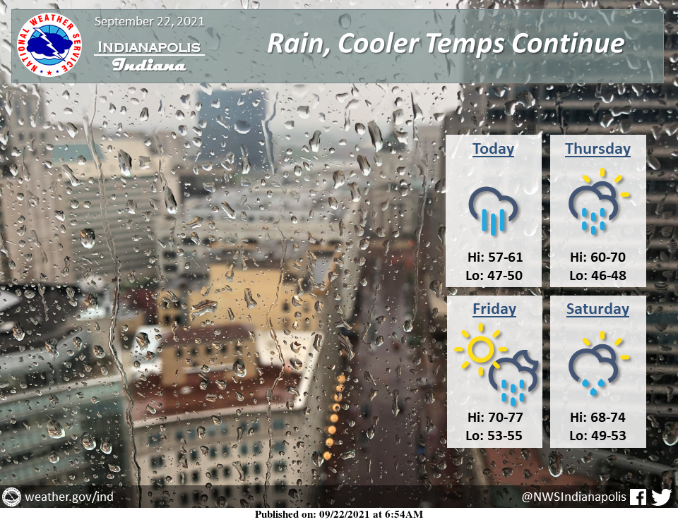
Rain and cooler temperatures will continue.
An additional 1 to 3 inches of rain is possible through tomorrow.
Localized flooding could also occur at times today and tonight – turn around, don't drown!
INDIANAPOLIS 7-DAY EXTENDED FORECAST
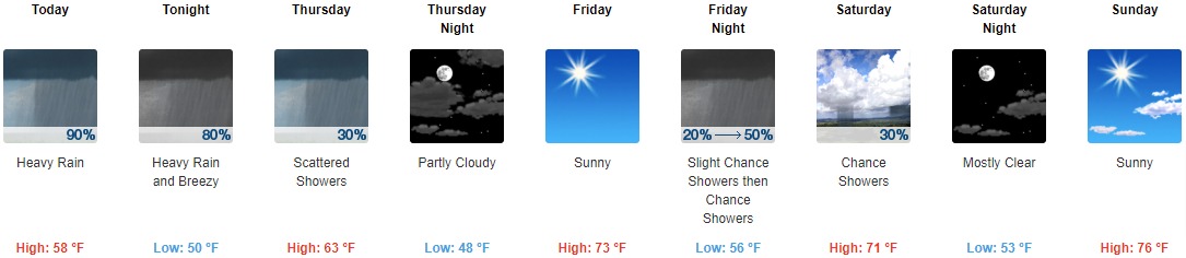
Today: Showers and possibly a thunderstorm. Some of the storms could produce heavy rainfall. High near 58. North northwest wind around 16 mph, with gusts as high as 31 mph. The chance of precipitation is 90%. New rainfall amounts between 1 and 2 inches possible.
Tonight: Showers and possibly a thunderstorm before 11pm, then showers likely. Some of the storms could produce heavy rainfall. Low around 50. Breezy, with a north northwest wind 15 to 20 mph, with gusts as high as 30 mph. The chance of precipitation is 80%. New precipitation amounts between three quarters and one inch possible.
Thursday: Scattered showers, mainly before 2pm. Mostly cloudy, with a high near 63. West wind around 14 mph, with gusts as high as 24 mph. The chance of precipitation is 30%.
Thursday Night: Partly cloudy, with a low around 48. West wind 6 to 9 mph.
Friday: Sunny, with a high near 73. West southwest wind 7 to 10 mph.
Friday Night: A 50 percent chance of showers, mainly after 2am. Mostly cloudy, with a low around 56. New precipitation amounts of less than a tenth of an inch are possible.
Saturday: A 30 percent chance of showers, mainly before 8am. Mostly sunny, with a high near 71.
Saturday Night: Mostly clear, with a low around 53.
Sunday: Sunny, with a high near 76.
Sunday Night: Mostly clear, with a low around 58.
Monday: Sunny, with a high near 79.
Monday Night: Mostly clear, with a low around 59.
Tuesday: Sunny, with a high near 79.
THE UNITED STATES OF AMERICA 3-DAY OUTLOOK


SOURCE: NWS Indianapolis.
Follow NWS Indianapolis on Twitter @NWSIndianapolis for the latest Indianapolis area weather news.