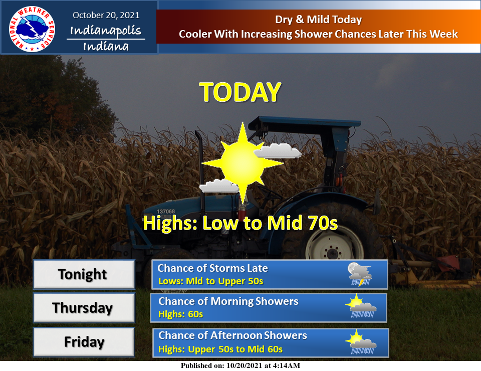
Dry and mild today.
Cooler with increasing shower chances later this week.
INDIANAPOLIS 7-DAY EXTENDED FORECAST
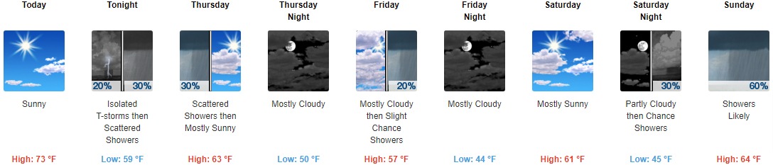
Today: Sunny, with a high near 73. Light south wind becoming south southwest 5 to 10 mph in the morning.
Tonight: Scattered showers and thunderstorms, mainly after 3am. Mostly cloudy, with a low around 59. South wind around 10 mph, with gusts as high as 23 mph. The chance of precipitation is 30%.
Thursday: Scattered showers, mainly before 7am. Mostly cloudy, then gradually becoming sunny, with a high near 63. Southwest wind 10 to 16 mph, with gusts as high as 23 mph. The chance of precipitation is 30%.
Thursday Night: Mostly cloudy, with a low around 50. West wind 3 to 7 mph.
Friday: A 20 percent chance of showers after 2pm. Mostly cloudy, with a high near 57. Calm wind becoming northwest around 5 mph in the afternoon.
Friday Night: Mostly cloudy, with a low around 44.
Saturday: Mostly sunny, with a high near 61.
Saturday Night: A 30 percent chance of showers after 2am. Partly cloudy, with a low around 45.
Sunday: Showers likely, mainly after 8am. Partly sunny, with a high near 64. The chance of precipitation is 60%.
Sunday Night: Showers likely and possibly a thunderstorm. Mostly cloudy, with a low around 55. The chance of precipitation is 70%.
Monday: A 40 percent chance of showers and thunderstorms. Mostly cloudy, with a high near 69.
Monday Night: A 30 percent chance of showers. Mostly cloudy, with a low around 57.
Tuesday: A 20 percent chance of showers. Mostly sunny, with a high near 72.
THE UNITED STATES OF AMERICA 3-DAY OUTLOOK


SOURCE: NWS Indianapolis.
Follow NWS Indianapolis on Twitter @NWSIndianapolis for the latest Indianapolis area weather news.