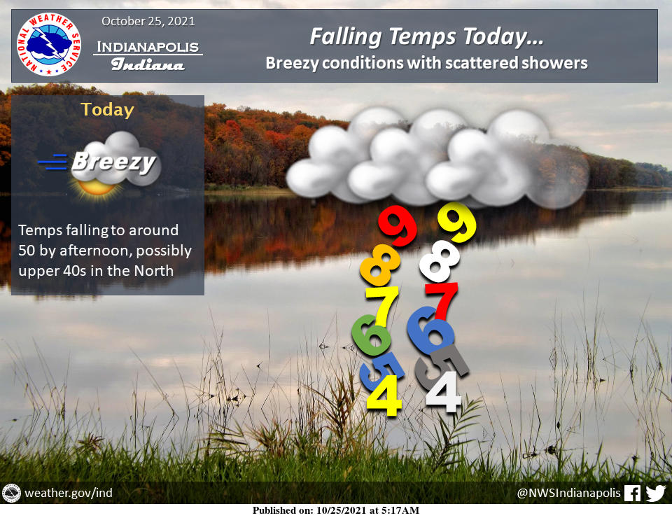
Rain steadily moves east of Indiana this morning, but in its wake will be breezy conditions as colder air steadily filters in.
Additionally expect temperatures to be falling by midday into the 50s and possibly the upper 40s across the Northern counties.
INDIANAPOLIS 7-DAY EXTENDED FORECAST
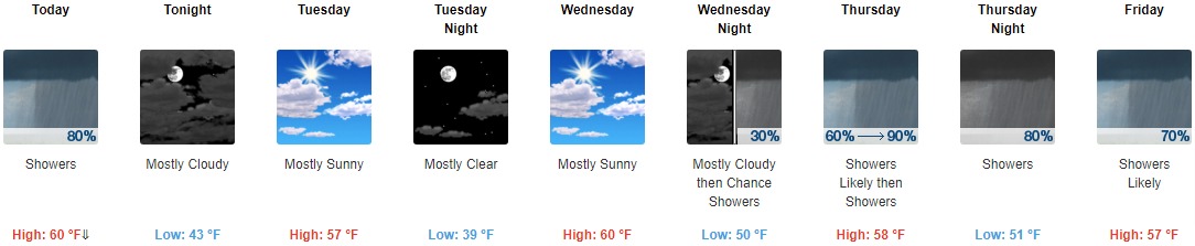
Today: Showers and possibly a thunderstorm before 1pm, then showers likely. Temperature falling to around 51 by 1pm. South wind 11 to 14 mph becoming west in the afternoon. Winds could gust as high as 25 mph. The chance of precipitation is 80%. New precipitation amounts of less than a tenth of an inch, except higher amounts possible in thunderstorms.
Tonight: Mostly cloudy, with a low around 43. North northwest wind 11 to 16 mph, with gusts as high as 26 mph.
Tuesday: Mostly sunny, with a high near 57. North wind around 10 mph.
Tuesday Night: Mostly clear, with a low around 39. Light north wind.
Wednesday: Mostly sunny, with a high near 60. Calm wind becoming east southeast 5 to 7 mph in the morning.
Wednesday Night: A 30 percent chance of showers after 2am. Mostly cloudy, with a low around 50.
Thursday: Showers, mainly after 8am. High near 58. The chance of precipitation is 90%.
Thursday Night: Showers. Low around 51. The chance of precipitation is 80%.
Friday: Showers likely. Mostly cloudy, with a high near 57. The chance of precipitation is 70%.
Friday Night: A 50 percent chance of showers. Mostly cloudy, with a low around 49.
Saturday: A 30 percent chance of showers. Mostly cloudy, with a high near 57.
Saturday Night: A 30 percent chance of showers. Partly cloudy, with a low around 45.
Sunday: Mostly sunny, with a high near 60.
THE UNITED STATES OF AMERICA 3-DAY OUTLOOK


SOURCE: NWS Indianapolis.
Follow NWS Indianapolis on Twitter @NWSIndianapolis for the latest Indianapolis area weather news.