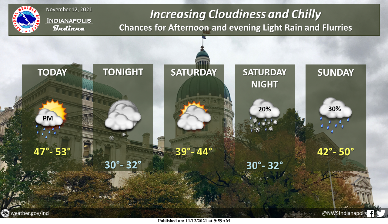
Expect increasing clouds this afternoon and evening with chances for light rain showers or flurries.
Chilly weekend ahead.
INDIANAPOLIS 7-DAY EXTENDED FORECAST
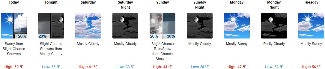
Today: A 20 percent chance of showers after 4pm. Increasing clouds, with a high near 50. West southwest wind 14 to 16 mph, with gusts as high as 29 mph.
Tonight: A 20 percent chance of showers before 10pm. Mostly cloudy, with a low around 33. West wind 11 to 14 mph, with gusts as high as 25 mph.
Saturday: Mostly cloudy, with a high near 41. West wind 11 to 13 mph, with gusts as high as 21 mph.
Saturday Night: Mostly cloudy, with a low around 33. West wind around 9 mph.
Sunday: A slight chance of rain and snow showers before 10am, then a chance of rain showers. Mostly cloudy, with a high near 44. South wind 10 to 15 mph becoming west in the afternoon. Winds could gust as high as 28 mph. The chance of precipitation is 30%.
Sunday Night: Mostly cloudy, with a low around 28.
Monday: Mostly sunny, with a high near 42.
Monday Night: Partly cloudy, with a low around 32.
Tuesday: Mostly sunny, with a high near 56.
Tuesday Night: Mostly cloudy, with a low around 49.
Wednesday: A 30 percent chance of showers. Mostly cloudy, with a high near 62.
Wednesday Night: Showers likely. Mostly cloudy, with a low around 40. The chance of precipitation is 60%.
Thursday: A 30 percent chance of showers. Partly sunny, with a high near 48.
THE UNITED STATES OF AMERICA 3-DAY OUTLOOK


SOURCE: NWS Indianapolis.
Follow NWS Indianapolis on Twitter @NWSIndianapolis for the latest Indianapolis area weather news.