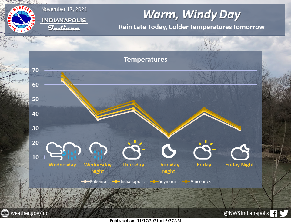
Expect warm and windy conditions for much of today.
A cold front will then bring showers across the area from this afternoon through tonight.
Temperatures will then return to below normal for the rest of the week
INDIANAPOLIS 7-DAY EXTENDED FORECAST
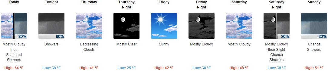
Today: Scattered showers, mainly after 3pm. Cloudy, with a high near 64. South southwest wind around 15 mph, with gusts as high as 31 mph. The chance of precipitation is 30%.
Tonight: Showers, mainly between 7pm and 1am. Low around 39. South southwest wind 8 to 14 mph becoming northwest after midnight. Winds could gust as high as 26 mph. The chance of precipitation is 90%. New precipitation amounts between a quarter and half of an inch possible.
Thursday: Mostly cloudy, then gradually becoming sunny, with a steady temperature around 41. West wind 8 to 15 mph, with gusts as high as 23 mph.
Thursday Night: Mostly clear, with a low around 25. West northwest wind 5 to 10 mph, with gusts as high as 20 mph.
Friday: Sunny, with a high near 42. Calm wind.
Friday Night: Mostly cloudy, with a low around 30.
Saturday: Mostly cloudy, with a high near 48.
Saturday Night: A 20 percent chance of showers after 1am. Mostly cloudy, with a low around 38.
Sunday: A 30 percent chance of showers. Mostly cloudy, with a high near 51.
Sunday Night: A 40 percent chance of showers. Mostly cloudy, with a low around 32.
Monday: Mostly sunny, with a high near 40.
Monday Night: Mostly clear, with a low around 23.
Tuesday: Sunny, with a high near 39.
THE UNITED STATES OF AMERICA 3-DAY OUTLOOK


SOURCE: NWS Indianapolis.
Follow NWS Indianapolis on Twitter @NWSIndianapolis for the latest Indianapolis area weather news.