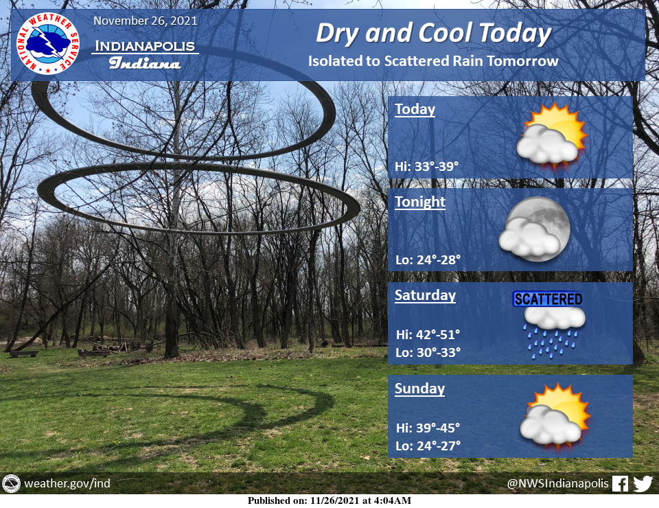
Dry and cool weather today with sub-freezing temperatures again tonight.
Isolated to scattered rain arrives tomorrow with the highest coverage across north-central Indiana.
Conditions then dry out again Sunday into the workweek.
INDIANAPOLIS 7-DAY EXTENDED FORECAST
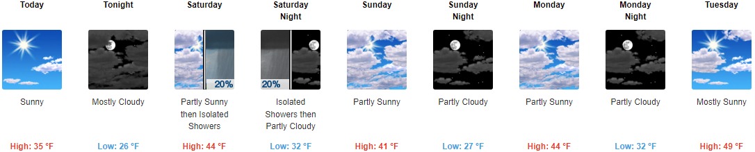
Today: Sunny, with a high near 35. West northwest wind 7 to 10 mph.
Tonight: Mostly cloudy, with a low around 26. West wind around 5 mph becoming light and variable.
Saturday: Isolated showers after 2pm. Partly sunny, with a high near 44. South southeast wind 7 to 10 mph. The chance of precipitation is 20%.
Saturday Night: Isolated showers before 8pm. Mostly cloudy, with a low around 32. Southwest wind 6 to 8 mph becoming west northwest after midnight. The chance of precipitation is 20%.
Sunday: Partly sunny, with a high near 41. Northwest wind around 10 mph, with gusts as high as 21 mph.
Sunday Night: Partly cloudy, with a low around 27.
Monday: Partly sunny, with a high near 44.
Monday Night: Partly cloudy, with a low around 32.
Tuesday: Mostly sunny, with a high near 49.
Tuesday Night: Mostly cloudy, with a low around 33.
Wednesday: Partly sunny, with a high near 47.
Wednesday Night: Partly cloudy, with a low around 36.
Thursday: Mostly sunny, with a high near 53.
THE UNITED STATES OF AMERICA 3-DAY OUTLOOK


SOURCE: NWS Indianapolis.
Follow NWS Indianapolis on Twitter @NWSIndianapolis for the latest Indianapolis area weather news.