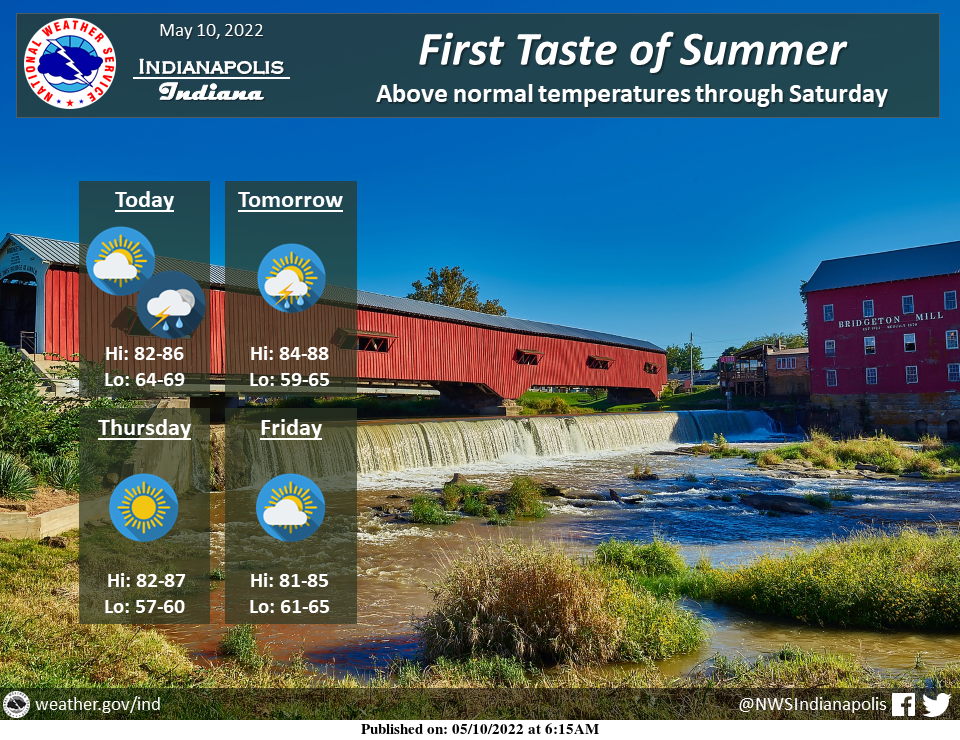
Early summer weather has arrived!
Temperatures will be in the mid to upper 80s over the next several days.
Most locations should remain dry, but an isolated thunderstorm cannot be ruled out tonight and tomorrow.
INDIANAPOLIS 7-DAY EXTENDED FORECAST
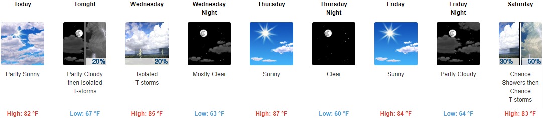
Today: Partly sunny, with a high near 82. South wind around 10 mph.
Tonight: Isolated showers and thunderstorms after 2am. Partly cloudy, with a low around 67. South southeast wind 6 to 8 mph. The chance of precipitation is 20%.
Wednesday: Isolated showers and thunderstorms. Mostly sunny, with a high near 85. Southeast wind 5 to 7 mph. The chance of precipitation is 20%.
Wednesday Night: Mostly clear, with a low around 63. East southeast wind around 6 mph.
Thursday: Sunny, with a high near 87. East southeast wind 5 to 8 mph.
Thursday Night: Clear, with a low around 60.
Friday: Sunny, with a high near 84.
Friday Night: Partly cloudy, with a low around 64.
Saturday: A chance of showers, with thunderstorms also possible after 2pm. Partly sunny, with a high near 83. The chance of precipitation is 50%.
Saturday Night: A chance of showers and thunderstorms. Mostly cloudy, with a low around 64. The chance of precipitation is 50%.
Sunday: A 40 percent chance of showers and thunderstorms. Partly sunny, with a high near 77.
Sunday Night: A 20 percent chance of showers and thunderstorms. Partly cloudy, with a low around 57.
Monday: A 20 percent chance of showers. Mostly sunny, with a high near 75.
THE UNITED STATES OF AMERICA 3-DAY OUTLOOK


SOURCE: NWS Indianapolis.
Follow NWS Indianapolis on Twitter @NWSIndianapolis for the latest Indianapolis area weather news.