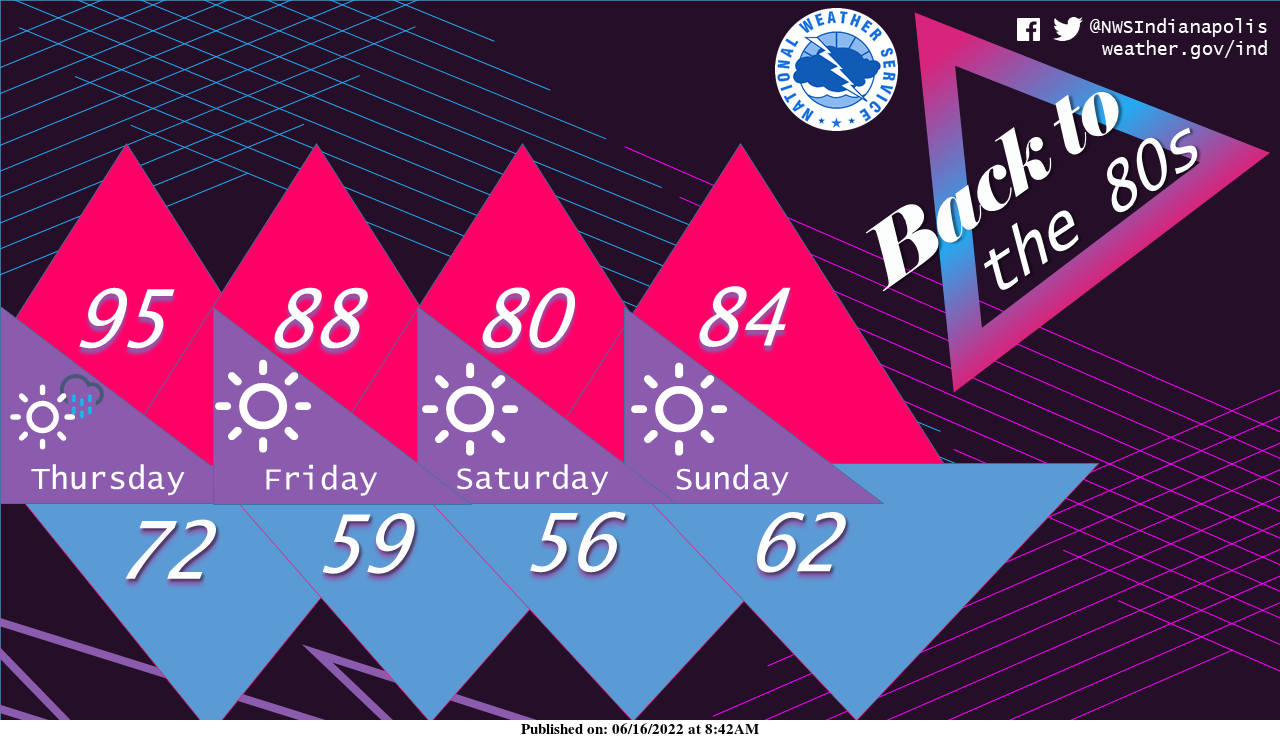
After a front cruises through overnight, the temperatures this weekend look totally rad. In fact, we're throwing it back to the 80s with lots of sun in the forecast for any weekend plans.
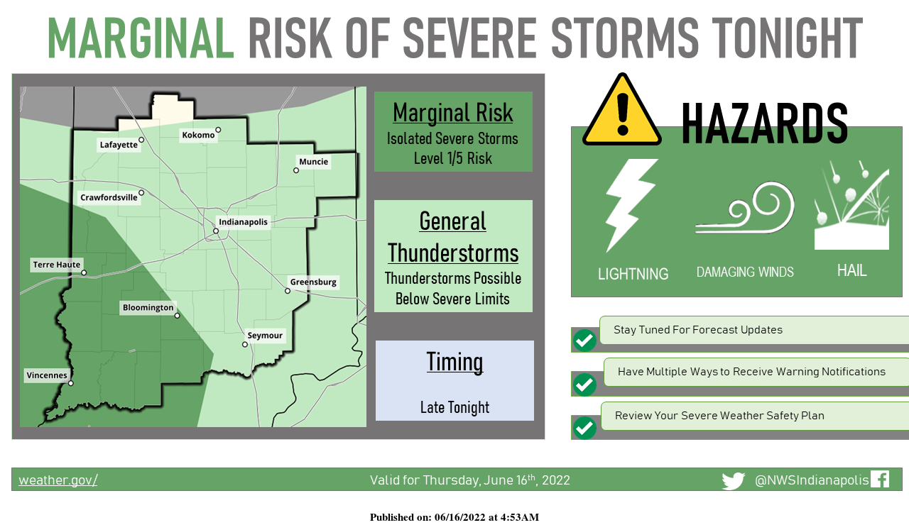
A weak cold front will bring thunderstorm chances to the region later today and especially tonight, with isolated severe storms possible in the darker green marginal risk area. Damaging winds will be the primary concern with the storms. Stay tuned for updates throughout the day today.
INDIANAPOLIS 7-DAY EXTENDED FORECAST
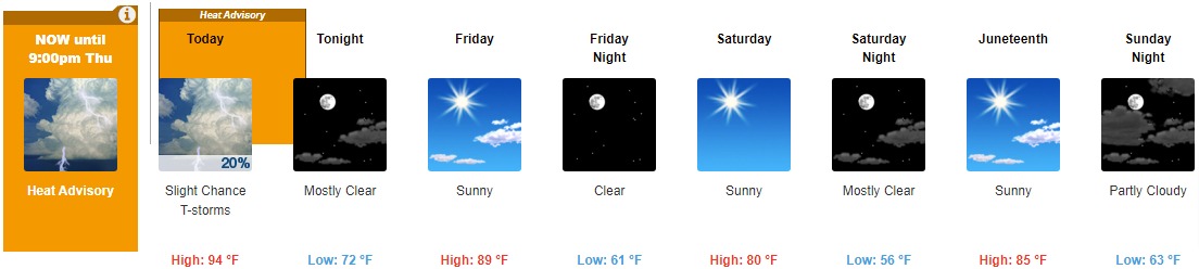
Today: A slight chance of showers before 11am, then a slight chance of showers and thunderstorms between 11am and 1pm. Partly sunny and hot, with a high near 94. Heat index values as high as 100. West wind around 11 mph, with gusts as high as 21 mph. Chance of precipitation is 20%.
Tonight: Mostly clear, with a low around 72. West southwest wind 6 to 8 mph.
Friday: Sunny, with a high near 89. Northwest wind 7 to 14 mph, with gusts as high as 22 mph.
Friday Night: Clear, with a low around 61. North wind 8 to 11 mph.
Saturday: Sunny, with a high near 80. North northeast wind around 11 mph, with gusts as high as 18 mph.
Saturday Night: Mostly clear, with a low around 56.
Juneteenth: Sunny, with a high near 85.
Sunday Night: Partly cloudy, with a low around 63.
Monday: Mostly sunny and hot, with a high near 93.
Monday Night: Mostly clear, with a low around 72.
Tuesday: Sunny and hot, with a high near 100.
Tuesday Night: Mostly clear, with a low around 75.
Wednesday: A 20 percent chance of showers and thunderstorms. Sunny and hot, with a high near 98.
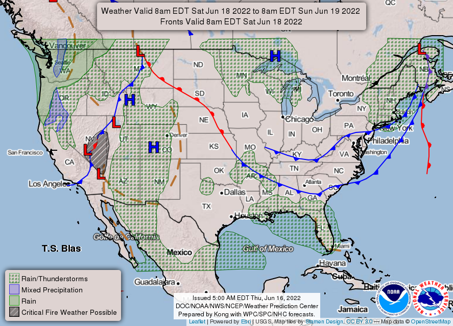
THE UNITED STATES OF AMERICA 3-DAY OUTLOOK


SOURCE: NWS Indianapolis.
Follow NWS Indianapolis on Twitter @NWSIndianapolis for the latest Indianapolis area weather news.