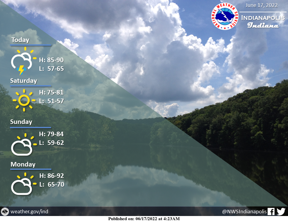
Some showers and thunderstorms will be around areas mainly south of a Terre Haute to Columbus line until early afternoon.
Otherwise dry conditions are expected into early next week.
Highs will be in the mid 80s to around 90 today, and in the middle 70s to middle 80s this weekend.
Warmer and more humid air returns once again next week.
INDIANAPOLIS 7-DAY EXTENDED FORECAST
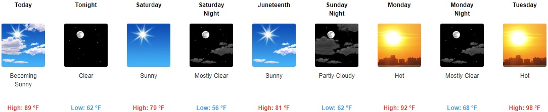
Today: Sunny and hot, with a high near 91. West northwest wind 7 to 13 mph, with gusts as high as 21 mph.
Tonight: Clear, with a low around 62. North wind 6 to 11 mph.
Saturday: Sunny, with a high near 79. North northeast wind around 10 mph, with gusts as high as 18 mph.
Saturday Night: Mostly clear, with a low around 56. North northeast wind 5 to 7 mph becoming calm in the evening.
Juneteenth: Sunny, with a high near 81. Light east wind.
Sunday Night: Partly cloudy, with a low around 62.
Monday: Mostly sunny and hot, with a high near 92.
Monday Night: Mostly clear, with a low around 68.
Tuesday: Sunny and hot, with a high near 98.
Tuesday Night: Mostly clear, with a low around 75.
Wednesday: A 20 percent chance of showers and thunderstorms. Mostly sunny and hot, with a high near 96.
Wednesday Night: A 20 percent chance of showers and thunderstorms. Partly cloudy, with a low around 71.
Thursday: A 20 percent chance of showers and thunderstorms. Mostly sunny and hot, with a high near 93.
THE UNITED STATES OF AMERICA 3-DAY OUTLOOK


SOURCE: NWS Indianapolis.
Follow NWS Indianapolis on Twitter @NWSIndianapolis for the latest Indianapolis area weather news.