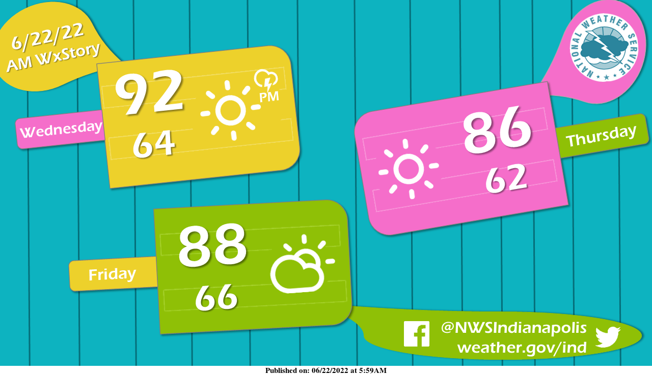
While POPs may be higher across southern portions of Indiana this afternoon, this warm weather will have everyone reaching for ice-cold popsicles later this week.
Under the sizzling summer sun, temperatures should stay in the upper 80s through the rest of the workweek.
INDIANAPOLIS 7-DAY EXTENDED FORECAST
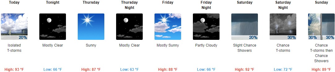
Today: Isolated showers and thunderstorms before 2pm, then isolated showers and thunderstorms after 3pm. Mostly sunny and hot, with a high near 93. Northwest wind 5 to 9 mph. The chance of precipitation is 20%.
Tonight: Mostly clear, with a low around 66. North wind 6 to 10 mph, with gusts as high as 18 mph.
Thursday: Sunny, with a high near 87. North northeast wind around 7 mph.
Thursday Night: Mostly clear, with a low around 63. North northeast wind around 6 mph becoming calm in the evening.
Friday: Mostly sunny, with a high near 88. Light south southeast wind.
Friday Night: Partly cloudy, with a low around 66.
Saturday: A 20 percent chance of showers before 2pm. Partly sunny and hot, with a high near 92.
Saturday Night: A slight chance of thunderstorms, then a chance of showers and thunderstorms after 8pm. Partly cloudy, with a low around 72. The chance of precipitation is 30%.
Sunday: A 30 percent chance of showers and thunderstorms. Partly sunny, with a high near 89.
Sunday Night: Partly cloudy, with a low around 63.
Monday: Sunny, with a high near 82.
Monday Night: Mostly clear, with a low around 58.
Tuesday: Sunny, with a high near 85.
THE UNITED STATES OF AMERICA 3-DAY OUTLOOK


SOURCE: NWS Indianapolis.
Follow NWS Indianapolis on Twitter @NWSIndianapolis for the latest Indianapolis area weather news.