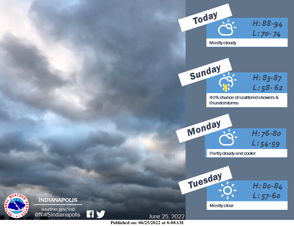
Look for clouds to increase across central Indiana today with above-average highs.
A cold front will bring the chance for showers and thunderstorms tomorrow.
Expect beautiful weather early next week as cooler and drier air moves in behind the front.
INDIANAPOLIS 7-DAY EXTENDED FORECAST
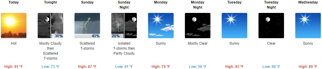
Today: Partly sunny and hot, with a high near 91. Light and variable wind becoming south southeast around 6 mph in the afternoon.
Tonight: Scattered showers and thunderstorms, mainly after 3am. Mostly cloudy, with a low around 73. South wind 3 to 7 mph. The chance of precipitation is 30%.
Sunday: Scattered showers and thunderstorms, mainly before 3pm. Mostly cloudy, with a high near 87. Calm wind becoming northwest 5 to 8 mph in the morning. The chance of precipitation is 40%.
Sunday Night: Isolated showers and thunderstorms before 9pm. Partly cloudy, with a low around 61. North wind 7 to 10 mph, with gusts as high as 20 mph. The chance of precipitation is 20%.
Monday: Sunny, with a high near 79. North wind 6 to 9 mph.
Monday Night: Mostly clear, with a low around 56.
Tuesday: Sunny, with a high near 83.
Tuesday Night: Clear, with a low around 60.
Wednesday: Sunny, with a high near 89.
Wednesday Night: Clear, with a low around 64.
Thursday: Sunny and hot, with a high near 93.
Thursday Night: A 20 percent chance of showers. Mostly clear, with a low around 72.
Friday: A 50 percent chance of showers and thunderstorms. Mostly sunny and hot, with a high near 92.
THE UNITED STATES OF AMERICA 3-DAY OUTLOOK


SOURCE: NWS Indianapolis.
Follow NWS Indianapolis on Twitter @NWSIndianapolis for the latest Indianapolis area weather news.