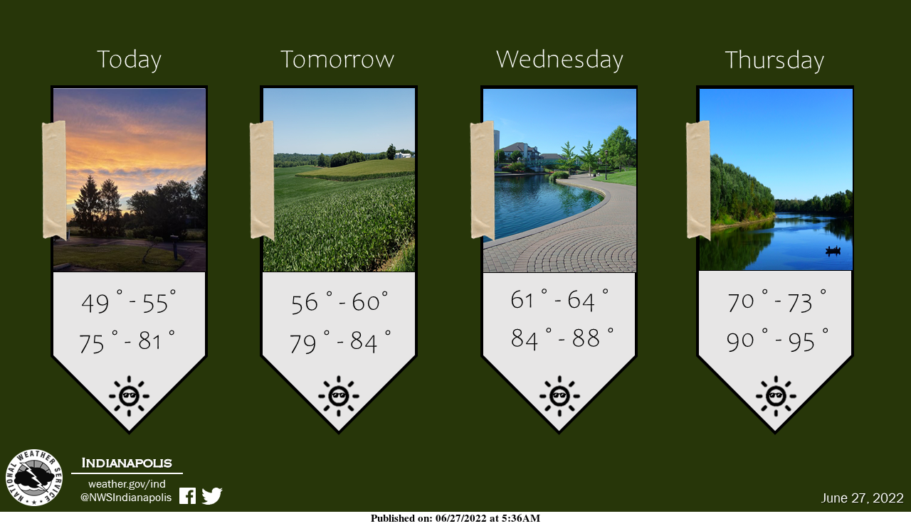
Get out your sunglasses because clouds have cleared and sunny summer weather is back!
Temperatures will creep towards the 90s as the week progresses, with temperatures slightly below average today and tomorrow.
INDIANAPOLIS 7-DAY EXTENDED FORECAST
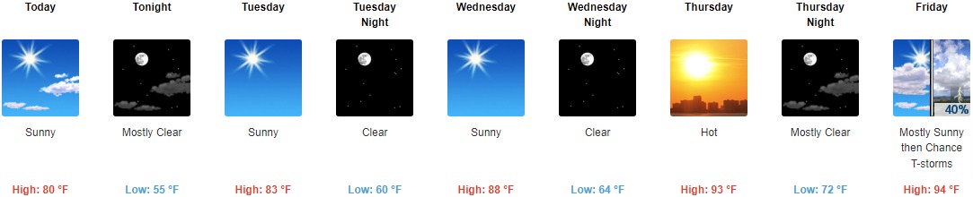
Today: Sunny, with a high near 80. Northwest wind 7 to 9 mph.
Tonight: Mostly clear, with a low around 55. Northeast wind 5 to 9 mph.
Tuesday: Sunny, with a high near 83. Light north northeast wind.
Tuesday Night: Clear, with a low around 60. Light and variable wind.
Wednesday: Sunny, with a high near 88. Calm wind becoming west southwest around 6 mph in the morning.
Wednesday Night: Clear, with a low around 64.
Thursday: Sunny and hot, with a high near 93.
Thursday Night: Mostly clear, with a low around 72.
Friday: A 40 percent chance of showers and thunderstorms after 2pm. Mostly sunny and hot, with a high near 94.
Friday Night: A chance of showers and thunderstorms, then showers likely after 2am. Mostly cloudy, with a low around 71. The chance of precipitation is 60%.
Saturday: Showers likely and possibly a thunderstorm. Partly sunny, with a high near 86. The chance of precipitation is 70%.
Saturday Night: A 40 percent chance of showers and thunderstorms. Mostly cloudy, with a low around 68.
Sunday: A 40 percent chance of showers and thunderstorms. Partly sunny, with a high near 85.
THE UNITED STATES OF AMERICA 3-DAY OUTLOOK


SOURCE: NWS Indianapolis.
Follow NWS Indianapolis on Twitter @NWSIndianapolis for the latest Indianapolis area weather news.