Good morning central Indiana!
We're waking up to a much quieter morning compared to yesterday, as showers and storms have stayed south of the region so far.
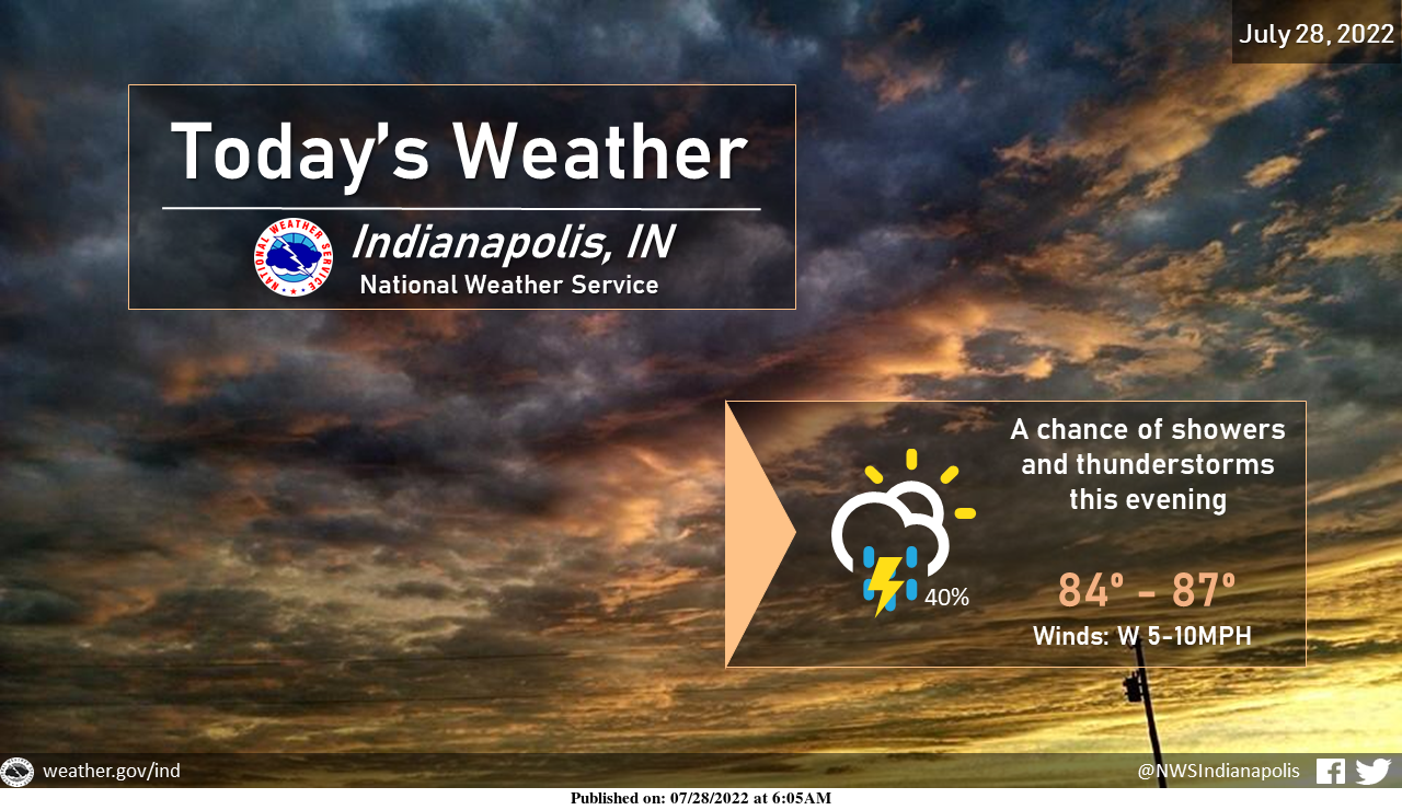
That could change later this evening when the chance of storms returns
INDIANAPOLIS 7-DAY EXTENDED FORECAST
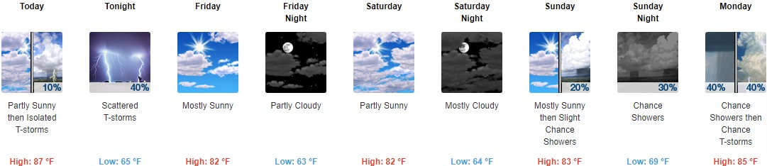
Today: Isolated showers and thunderstorms after 5pm. Mostly sunny, with a high near 87. West wind 5 to 10 mph. The chance of precipitation is 10%.
Tonight: Scattered showers and thunderstorms, mainly between 7pm and 2am. Mostly cloudy, with a low around 65. West wind 5 to 8 mph becoming north northwest after midnight. The chance of precipitation is 40%.
Friday: Mostly sunny, with a high near 82. Light north northwest wind becoming northwest 5 to 9 mph in the morning.
Friday Night: Partly cloudy, with a low around 63. Northwest wind 5 to 7 mph becoming calm in the evening.
Saturday: Partly sunny, with a high near 82. Light and variable wind.
Saturday Night: Mostly cloudy, with a low around 64.
Sunday: A 20 percent chance of showers after 2pm. Mostly sunny, with a high near 83.
Sunday Night: A 30 percent chance of showers, mainly after 2am. Partly cloudy, with a low around 69.
Monday: A 40 percent chance of showers and thunderstorms. Partly sunny, with a high near 85.
Monday Night: A chance of showers and thunderstorms. Partly cloudy, with a low around 72. The chance of precipitation is 40%.
Tuesday: A 40 percent chance of showers and thunderstorms. Mostly sunny, with a high near 88.
Tuesday Night: A 30 percent chance of showers and thunderstorms. Mostly clear, with a low around 71.
Wednesday: Mostly sunny and hot, with a high near 91.
THE UNITED STATES OF AMERICA 3-DAY OUTLOOK


SOURCE: NWS Indianapolis.
Follow NWS Indianapolis on Twitter @NWSIndianapolis for the latest Indianapolis area weather news.