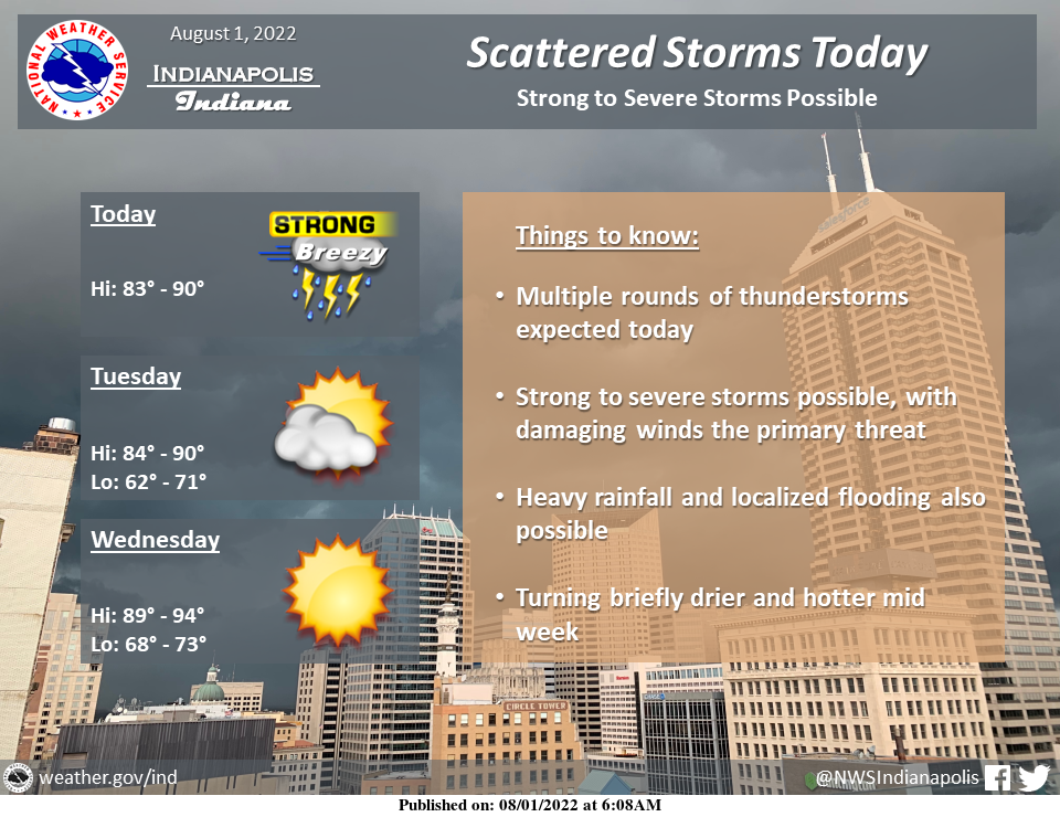
Multiple rounds of thunderstorms are expected today across central Indiana, with severe storms possible.
Damaging winds, heavy rain, and localized flooding are the primary threats. Mid-week will be briefly dry and hotter.
MONDAY MORNING STORMS
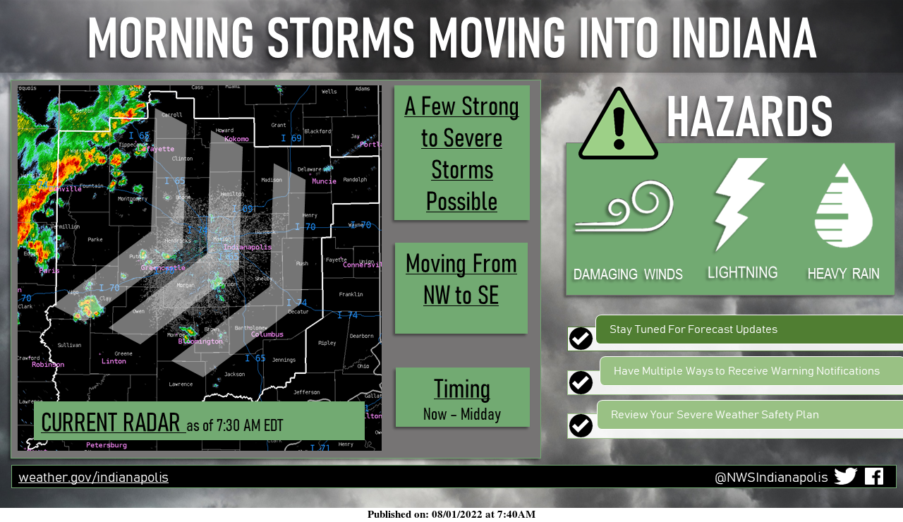
A lingering line of strong thunderstorms is moving into Indiana this morning.
Frequent lightning and heavy rain are expected, but the strongest cells may produce damaging winds.
A few isolated showers ahead of this main line may make for a wet morning commute.
SLIGHT RISK OF SEVERE STORMS
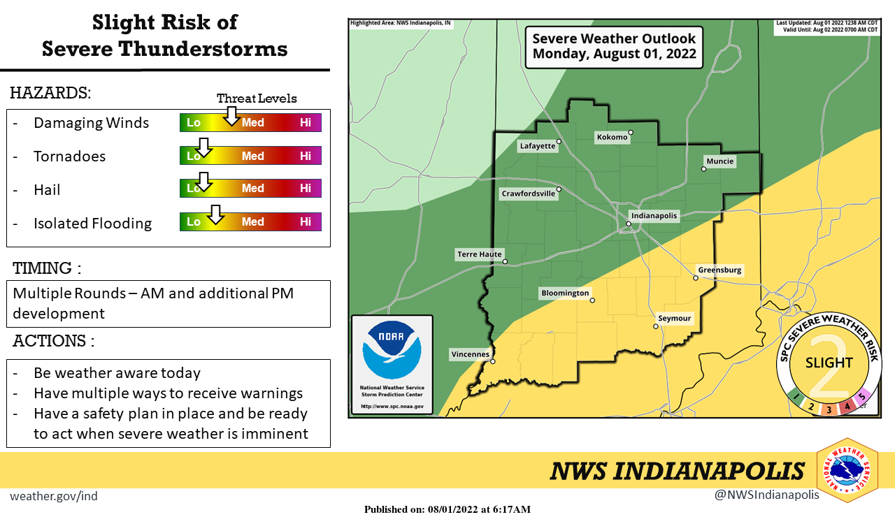
There is a slight risk of severe thunderstorms today, with multiple rounds possible, one this morning and additional development later this afternoon.
Damaging winds, heavy rain, and localized flooding are the primary threats.
Be weather aware today!
INDIANAPOLIS 7-DAY EXTENDED FORECAST
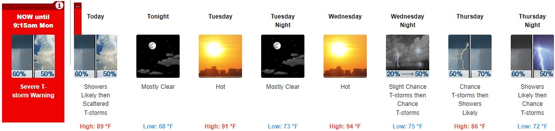
Today: Showers likely and possibly a thunderstorm between 10am and noon, then a chance of showers and thunderstorms after noon. Mostly cloudy, with a high near 89. West southwest wind 8 to 17 mph, with gusts as high as 25 mph. The chance of precipitation is 60%. New rainfall amounts of less than a tenth of an inch, except higher amounts possible in thunderstorms.
Tonight: Mostly clear, with a low around 68. West wind 10 to 15 mph becoming light west northwest after midnight. Winds could gust as high as 22 mph.
Tuesday: Mostly sunny and hot, with a high near 91. Light west northwest wind.
Tuesday Night: Mostly clear, with a low around 73. South wind 5 to 7 mph.
Wednesday: Sunny and hot, with a high near 94. South southwest wind 6 to 14 mph, with gusts as high as 25 mph.
Wednesday Night: A 50 percent chance of showers and thunderstorms, mainly after 3am. Partly cloudy, with a low around 75. New rainfall amounts between a tenth and quarter of an inch, except higher amounts possible in thunderstorms.
Thursday: A chance of showers and thunderstorms, then showers likely and possibly a thunderstorm after 3pm. Mostly cloudy, with a high near 86. The chance of precipitation is 70%.
Thursday Night: Showers likely and possibly a thunderstorm before 9pm, then a chance of showers and thunderstorms after 9pm. Mostly cloudy, with a low around 72. The chance of precipitation is 70%.
Friday: A 40 percent chance of showers and thunderstorms. Mostly sunny, with a high near 87.
Friday Night: A 40 percent chance of showers and thunderstorms before 9pm. Partly cloudy, with a low around 71.
Saturday: A 20 percent chance of showers and thunderstorms. Mostly sunny, with a high near 90.
Saturday Night: A 20 percent chance of showers and thunderstorms. Partly cloudy, with a low around 73.
Sunday: A 30 percent chance of showers and thunderstorms. Mostly sunny, with a high near 90.
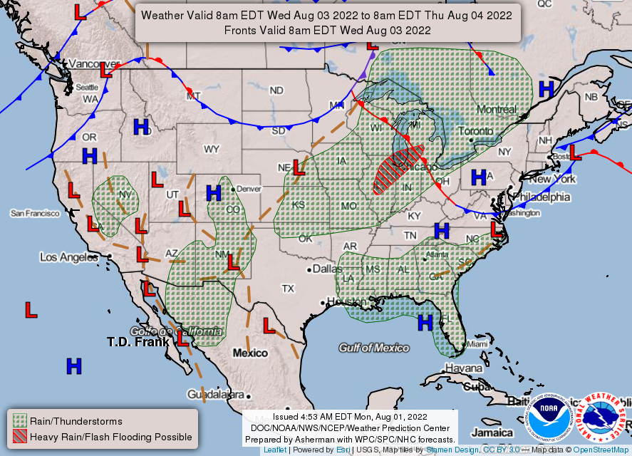
THE UNITED STATES OF AMERICA 3-DAY OUTLOOK


SOURCE: NWS Indianapolis.
Follow NWS Indianapolis on Twitter @NWSIndianapolis for the latest Indianapolis area weather news.