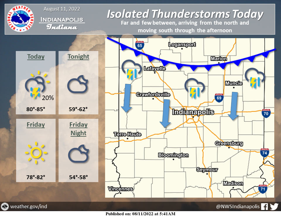
A weak cold front is expected to sweep southward across Indiana today.
A few showers and thunderstorms may develop along the front as it passes through.
Most places should remain dry, but a few lucky spots may get a brief downpour or a rumble of thunder this afternoon.
INDIANAPOLIS 7-DAY EXTENDED FORECAST
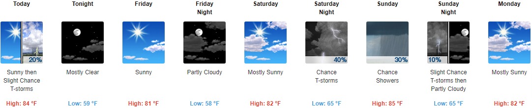
Today: A 20 percent chance of showers and thunderstorms after 2pm. Mostly sunny, with a high near 84. Calm wind becoming north northwest around 6 mph in the afternoon.
Tonight: Mostly clear, with a low around 59. North northeast wind 5 to 10 mph.
Friday: Sunny, with a high near 81. East northeast wind 5 to 7 mph.
Friday Night: Partly cloudy, with a low around 58. Northeast wind around 6 mph becoming calm in the evening.
Saturday: Mostly sunny, with a high near 82. Calm wind becoming south 5 to 7 mph in the morning.
Saturday Night: A slight chance of showers, then a chance of showers and thunderstorms after 11pm. Mostly cloudy, with a low around 65. Chance of precipitation is 40%.
Sunday: A chance of showers and thunderstorms before 8am, then a chance of showers between 8am and 2pm, then a slight chance of showers and thunderstorms after 2pm. Partly sunny, with a high near 85. Chance of precipitation is 30%.
Sunday Night: A 10 percent chance of showers and thunderstorms before 8pm. Partly cloudy, with a low around 65.
Monday: Mostly sunny, with a high near 82.
Monday Night: Partly cloudy, with a low around 62.
Tuesday: Mostly sunny, with a high near 81.
Tuesday Night: Partly cloudy, with a low around 62.
Wednesday: Sunny, with a high near 81.
THE UNITED STATES OF AMERICA 3-DAY OUTLOOK


SOURCE: NWS Indianapolis.
Follow NWS Indianapolis on Twitter @NWSIndianapolis for the latest Indianapolis area weather news.