Ongoing scattered thunderstorms will come to an end by mid-morning.
While the severe threat has diminished, localized flooding remains possible across far Southwestern portions of central Indiana.
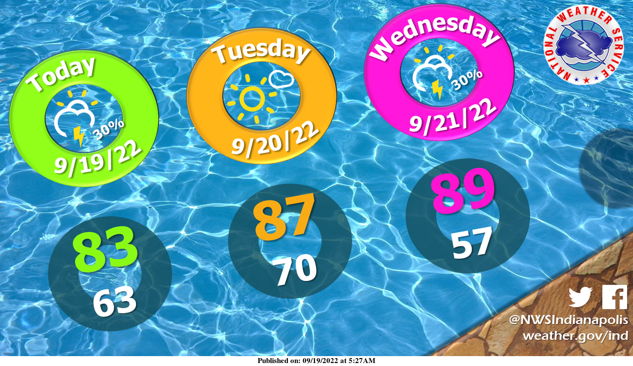
Hot summer weather returns over the next few days with highs in the upper 80s.
INDIANAPOLIS 7-DAY EXTENDED FORECAST
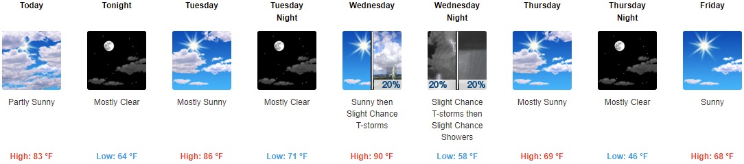
Today: Partly sunny, with a high near 83. West northwest wind 6 to 9 mph.
Tonight: Mostly clear, with a low around 64. Light and variable wind.
Tuesday: Mostly sunny, with a high near 86. Calm wind becoming south around 6 mph in the afternoon.
Tuesday Night: Mostly clear, with a low around 71. South southwest wind around 6 mph.
Wednesday: A 20 percent chance of showers and thunderstorms after 2pm. Mostly sunny, with a high near 90. Southwest wind 6 to 10 mph, with gusts as high as 21 mph.
Wednesday Night: A slight chance of showers and thunderstorms before 11pm, then a slight chance of showers between 11pm and 2am. Mostly cloudy, with a low of around 58. The chance of precipitation is 20%.
Thursday: Mostly sunny, with a high near 69.
Thursday Night: Mostly clear, with a low around 46.
Friday: Sunny, with a high near 68.
Friday Night: A 20 percent chance of showers after 2am. Mostly cloudy, with a low of around 54.
Saturday: A 10 percent chance of showers. Partly sunny, with a high near 75.
Saturday Night: Partly cloudy, with a low around 56.
Sunday: A 20 percent chance of showers. Mostly sunny, with a high near 77.
THE UNITED STATES OF AMERICA 3-DAY OUTLOOK


SOURCE: NWS Indianapolis.
Follow NWS Indianapolis on Twitter @NWSIndianapolis for the latest Indianapolis area weather news.