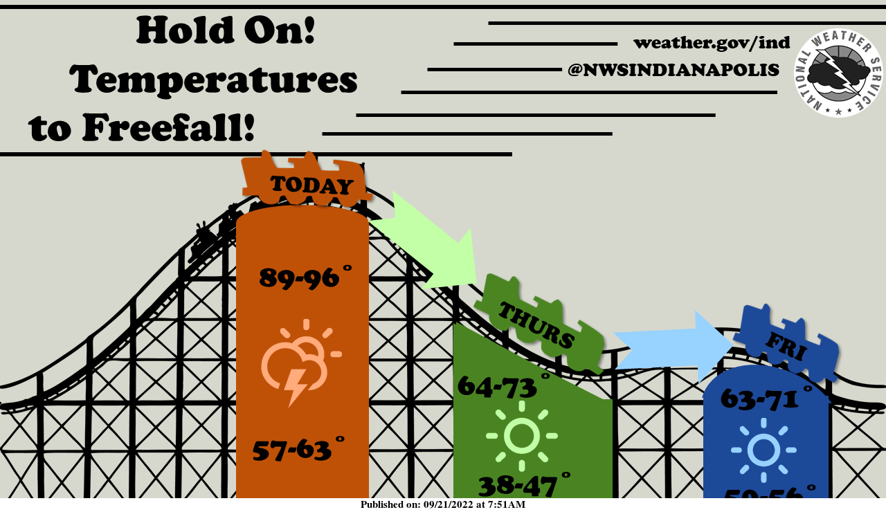
Temperatures will be starting off hot today but quickly plummet tonight and Thursday in the wake of a strong cold front.
Strong and marginally severe thunderstorms are possible this afternoon and evening with damaging winds, large hail, and lightning possible.
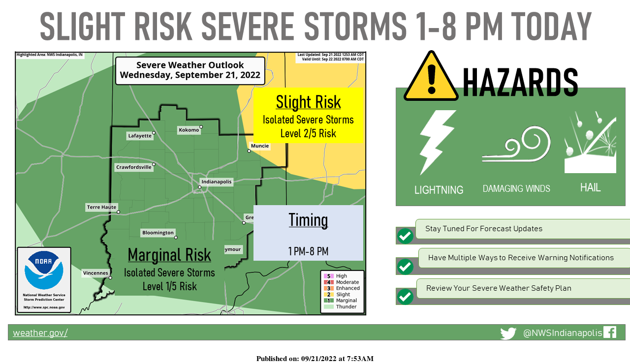
A strong cold front will bring scattered thunderstorms to central Indiana this afternoon and early evening.
A few severe storms are possible with damaging winds, large hail, and lightning, the main threats.
When Thunder Roars, Go Indoors!
INDIANAPOLIS 7-DAY EXTENDED FORECAST
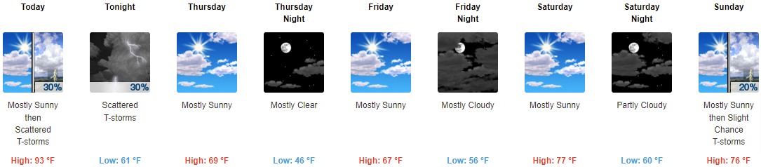
Today: Scattered showers and thunderstorms, mainly after 3pm. Mostly sunny and hot, with a high near 93. West southwest wind 8 to 13 mph, with gusts as high as 23 mph. The chance of precipitation is 30%.
Tonight: Scattered showers and thunderstorms, mainly before 11pm. Mostly cloudy, with a low of around 61. North wind around 10 mph, with gusts as high as 18 mph. The chance of precipitation is 30%.
Thursday: Mostly sunny, with a high near 69. North northwest wind 7 to 14 mph, with gusts as high as 22 mph.
Thursday Night: Mostly clear, with a low around 46. North wind 6 to 11 mph, with gusts as high as 22 mph.
Friday: Mostly sunny, with a high near 67. Calm wind becoming east northeast around 5 mph.
Friday Night: Mostly cloudy, with a low of around 56.
Saturday: Mostly sunny, with a high near 77.
Saturday Night: Partly cloudy, with a low around 60.
Sunday: A 20 percent chance of showers and thunderstorms after 2pm. Mostly sunny, with a high near 76.
Sunday Night: A 10 percent chance of showers and thunderstorms before 8pm. Partly cloudy, with a low of around 53.
Monday: Sunny, with a high near 70.
Monday Night: Mostly clear, with a low around 51.
Tuesday: Sunny, with a high near 70.
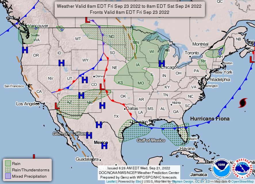
THE UNITED STATES OF AMERICA 3-DAY OUTLOOK

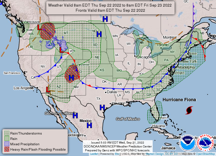
SOURCE: NWS Indianapolis.
Follow NWS Indianapolis on Twitter @NWSIndianapolis for the latest Indianapolis area weather news.