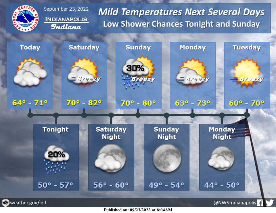
Temperatures will be cool to mild throughout the next several days, with low chances for showers tonight and Sunday.
Otherwise, dry weather is expected.
Breezy conditions can be expected during the day this weekend into early next week.
INDIANAPOLIS 7-DAY EXTENDED FORECAST
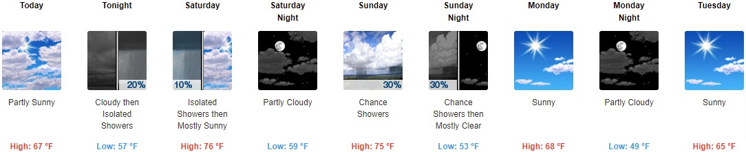
Today: Partly sunny, with a high near 67. North northeast wind around 6 mph becomes light and variable in the afternoon.
Tonight: Scattered sprinkles between 11pm and 3am, then isolated showers after 3am. Cloudy, with a low of around 57. South southeast wind 3 to 5 mph. The chance of precipitation is 20%.
Saturday: Isolated showers before 7am, then scattered sprinkles between 7am and 8am. Cloudy through mid-morning, then gradual clearing, with a high near 76. South southeast wind 7 to 11 mph, with gusts as high as 18 mph. The chance of precipitation is 10%.
Saturday Night: Partly cloudy, with a low around 59. West southwest wind around 6 mph.
Sunday: A 30 percent chance of showers, mainly after 2pm. Mostly sunny, with a high near 75. West northwest wind 6 to 14 mph, with gusts as high as 28 mph.
Sunday Night: A 30 percent chance of showers before 8pm. Mostly clear, with a low of around 53.
Monday: Sunny, with a high near 68.
Monday Night: Partly cloudy, with a low around 49.
Tuesday: Sunny, with a high near 65.
Tuesday Night: Mostly clear, with a low around 45.
Wednesday: Mostly sunny, with a high near 66.
Wednesday Night: Mostly clear, with a low of around 45.
Thursday: Sunny, with a high near 67.
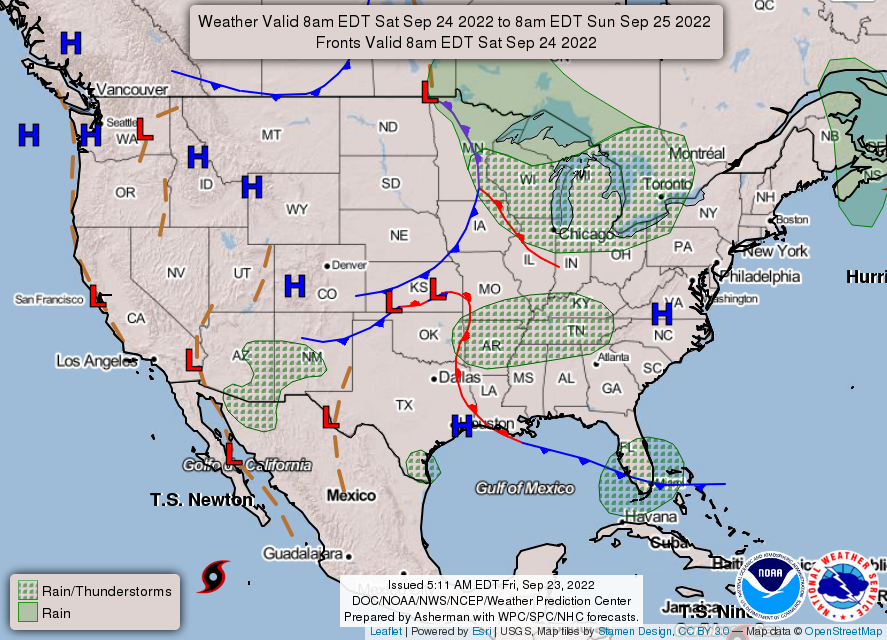
THE UNITED STATES OF AMERICA 3-DAY OUTLOOK


SOURCE: NWS Indianapolis.
Follow NWS Indianapolis on Twitter @NWSIndianapolis for the latest Indianapolis area weather news.