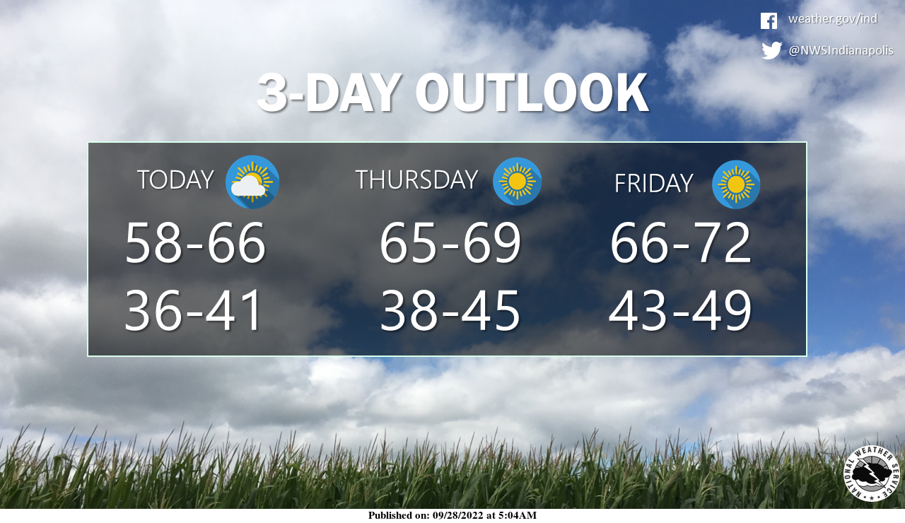
Cool and dry weather will continue through the rest of the week.
Clouds and northerly winds will keep temperatures coolest today with highs ranging from the upper 50s to the mid-60s.
With increasing sunshine, highs will rise into the mid and upper 60s for late week.
Patchy frost is possible late tonight and possibly Thursday night as well, mainly across northern portions of central Indiana.
INDIANAPOLIS 7-DAY EXTENDED FORECAST
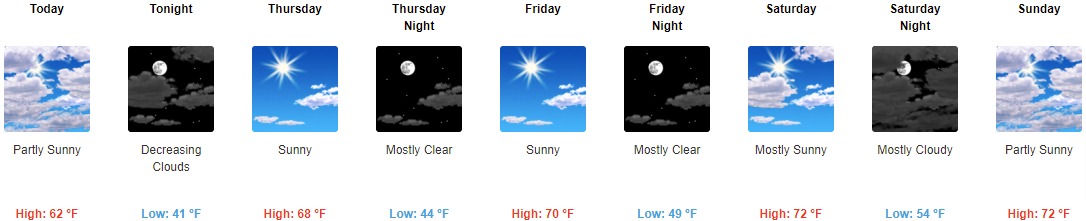
Today: Partly sunny, with a high near 62. North wind 5 to 11 mph.
Tonight: Mostly cloudy, then gradually becoming clear, with a low of around 41. North northeast wind 5 to 8 mph becoming calm after midnight.
Thursday: Sunny, with a high near 68. East northeast wind 5 to 8 mph.
Thursday Night: Mostly clear, with a low around 44. East northeast wind around 7 mph.
Friday: Sunny, with a high near 70. East northeast wind 6 to 9 mph.
Friday Night: Mostly clear, with a low around 49.
Saturday: Mostly sunny, with a high near 72.
Saturday Night: Mostly cloudy, with a low of around 54.
Sunday: Partly sunny, with a high near 72.
Sunday Night: Partly cloudy, with a low of around 53.
Monday: Mostly sunny, with a high near 72.
Monday Night: Partly cloudy, with a low of around 52.
Tuesday: Mostly sunny, with a high near 71.
THE UNITED STATES OF AMERICA 3-DAY OUTLOOK


SOURCE: NWS Indianapolis.
Follow NWS Indianapolis on Twitter @NWSIndianapolis for the latest Indianapolis area weather news.