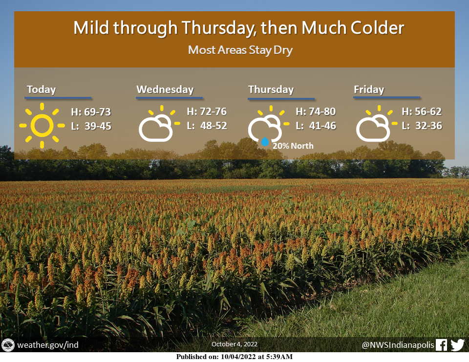
Mild to warm conditions will continue into Thursday.
Highs today will be in the upper 60s to lower 70s.
By Thursday highs will be in the middle 70s to near 80.
However, much colder air arrives to end the week, with highs on Friday only in the middle 50s to lower 60s.
Isolated showers are possible across northern portions of central Indiana Thursday.
Otherwise dry conditions will persist.
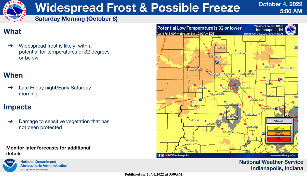
Cold air will move in for this upcoming weekend.
Widespread frost is likely early Saturday morning, and there is a potential for some freezing temperatures.
These conditions could damage or kill unprotected sensitive vegetation.
Monitor later forecasts for additional details.
INDIANAPOLIS 7-DAY EXTENDED FORECAST
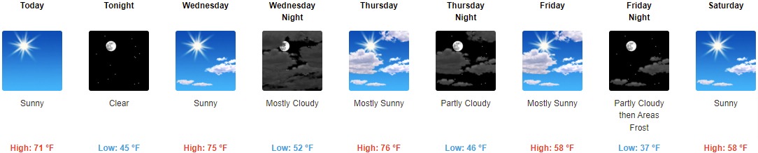
Today: Sunny, with a high near 71. Light northeast wind.
Tonight: Clear, with a low of around 45. Light north northeast wind.
Wednesday: Sunny, with a high near 75. Light and variable wind.
Wednesday Night: Mostly cloudy, with a low of around 52. Calm wind.
Thursday: Mostly sunny, with a high near 76. Calm wind becoming southwest 5 to 8 mph in the morning.
Thursday Night: Partly cloudy, with a low around 46.
Friday: Mostly sunny, with a high near 58.
Friday Night: Areas of frost after 5am. Otherwise, mostly clear, with a low around 37.
Saturday: Sunny, with a high near 58.
Saturday Night: Mostly clear, with a low around 38.
Sunday: Sunny, with a high near 64.
Sunday Night: Mostly clear, with a low around 44.
Columbus Day: Mostly sunny, with a high near 69.
THE UNITED STATES OF AMERICA 3-DAY OUTLOOK


SOURCE: NWS Indianapolis.
Follow NWS Indianapolis on Twitter @NWSIndianapolis for the latest Indianapolis area weather news.