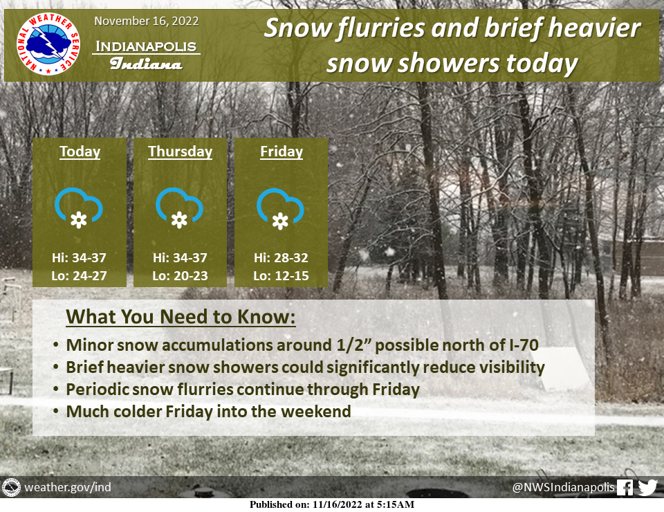
Scattered snow showers are expected today, and these could produce significant visibility reductions at times.
Accumulation will be minor but could be around one-half inch north of I-70.
Snow flurries will continue periodically through Friday.
Much colder temperatures will arrive Friday and continue into the weekend.
INDIANAPOLIS 7-DAY EXTENDED FORECAST
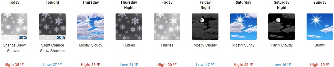
Today: A 30 percent chance of snow showers, mainly after 1pm. Mostly cloudy, with a high near 35. West wind 8 to 13 mph, with gusts as high as 23 mph.
Tonight: A 20 percent chance of snow showers before 1am. Mostly cloudy, with a low of around 27. West wind 9 to 11 mph, with gusts as high as 22 mph.
Thursday: Mostly cloudy, with a high near 35. West southwest wind 6 to 11 mph, with gusts as high as 21 mph.
Thursday Night: Occasional flurries. Mostly cloudy, with a low around 24. West wind around 8 mph, with gusts as high as 18 mph.
Friday: Occasional flurries before 1pm. Partly sunny, with a high near 30. West wind 9 to 14 mph, with gusts as high as 23 mph.
Friday Night: Mostly cloudy, with a low of around 17.
Saturday: Mostly sunny, with a high near 33.
Saturday Night: Partly cloudy, with a low around 16.
Sunday: Sunny, with a high near 29.
Sunday Night: Mostly clear, with a low around 19.
Monday: Sunny, with a high near 41.
Monday Night: Mostly clear, with a low around 27.
Tuesday: Sunny, with a high near 48.
THE UNITED STATES OF AMERICA 3-DAY OUTLOOK


SOURCE: NWS Indianapolis.
Follow NWS Indianapolis on Twitter @NWSIndianapolis for the latest Indianapolis area weather news.