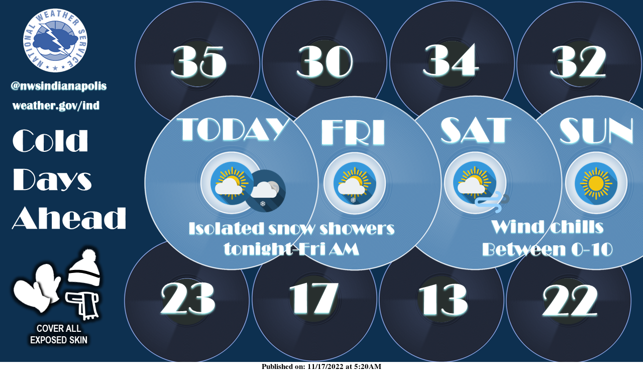
Isolated snow showers are possible tonight through Friday morning with light accumulations in spots.
Colder temperatures are on the way this weekend.
Gusty winds will make it feel even colder with 0-10 degree wind chills expected.
Make sure to dress warm and prep the hot cocoa!
BLACK ICE WARNING
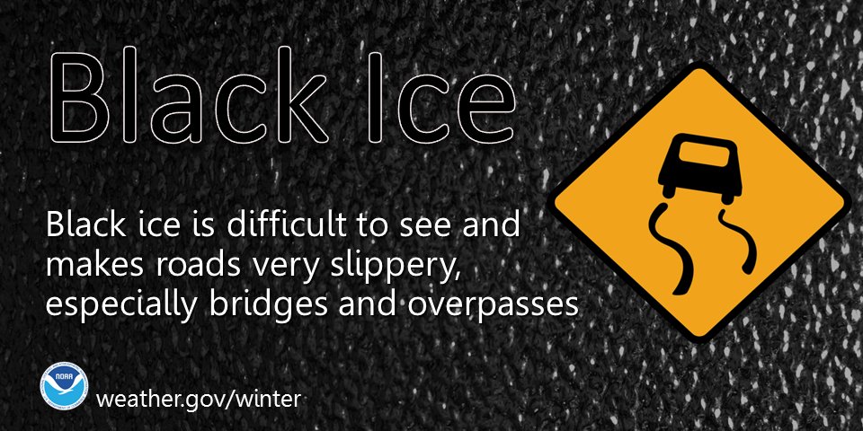
Patches of black ice may cause a few slick spots on sidewalks and roads early this morning.
Conditions should continue to improve through mid-morning as roads dry out.
INDIANAPOLIS 7-DAY EXTENDED FORECAST
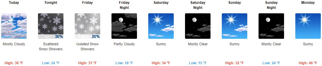
Today: Mostly cloudy, with a high near 36. West southwest wind 9 to 13 mph, with gusts as high as 22 mph.
Tonight: Scattered flurries between 9pm and 10pm, then scattered snow showers after 10pm. Cloudy, with a low around 24. West wind 6 to 8 mph, with gusts as high as 18 mph. The chance of precipitation is 30%.
Friday: Isolated snow showers before 1pm. Cloudy, with a high near 31. West wind 9 to 14 mph, with gusts as high as 22 mph. The chance of precipitation is 20%.
Friday Night: Partly cloudy, with a low around 18. West wind around 7 mph.
Saturday: Sunny, with a high near 34. Southwest wind 7 to 16 mph, with gusts as high as 29 mph.
Saturday Night: Mostly clear, with a low around 15.
Sunday: Sunny, with a high near 32.
Sunday Night: Mostly clear, with a low around 24.
Monday: Sunny, with a high near 46.
Monday Night: Mostly clear, with a low around 30.
Tuesday: Sunny, with a high near 50.
Tuesday Night: Partly cloudy, with a low around 34.
Wednesday: A 20 percent chance of rain. Partly sunny, with a high near 52.
THE UNITED STATES OF AMERICA 3-DAY OUTLOOK


SOURCE: NWS Indianapolis.
Follow NWS Indianapolis on Twitter @NWSIndianapolis for the latest Indianapolis area weather news.