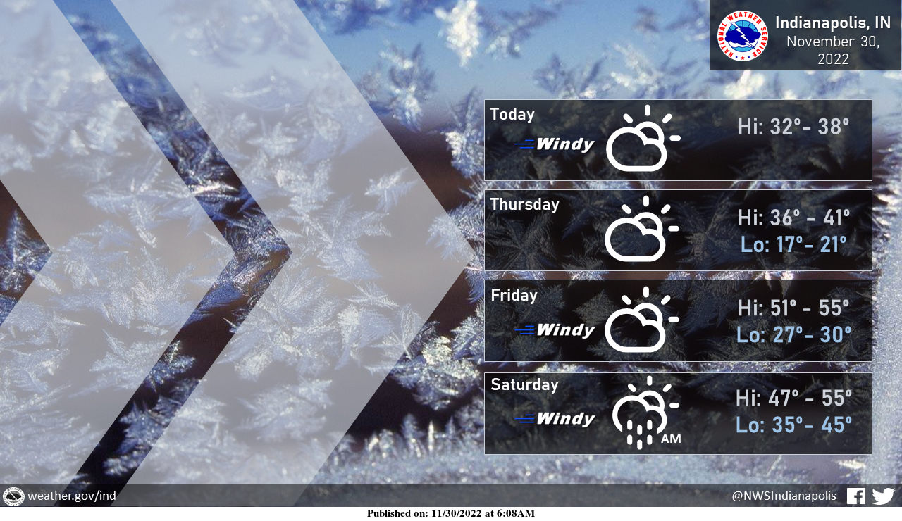
Last night's cold front brought much colder weather to the area today!
Additionally, gusty northwest winds will make it feel much colder than it actually is. Gusts between 30 and 40 mph are possible this afternoon.
The cold won't last too long with a warm-up by Friday.
OVERNIGHT WINDS AND POWER OUTAGES
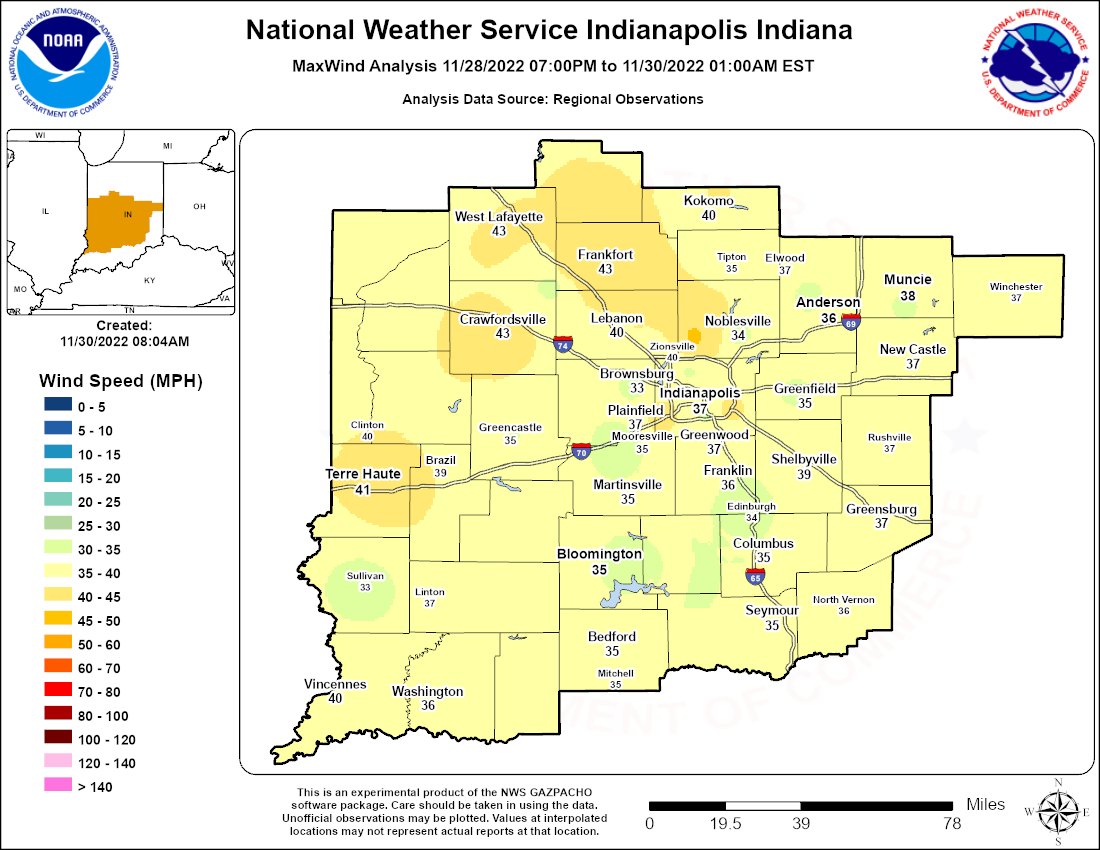
A gusty overnight period has led to isolated power outages.
Peak wind gusts were generally between 40-45 mph with a few pockets of stronger winds as the line of showers passed through. Be prepared for continued gusts to 40 mph today.
INDIANAPOLIS 7-DAY EXTENDED FORECAST
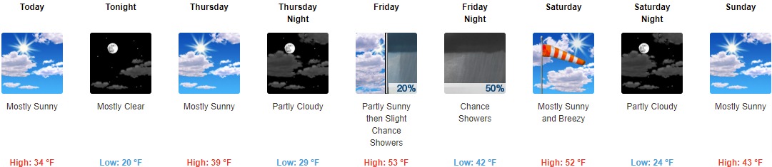
Today: Mostly sunny, with a high near 34. West wind around 17 mph, with gusts as high as 32 mph.
Tonight: Mostly clear, with a low of around 20. West wind 6 to 14 mph, with gusts as high as 24 mph.
Thursday: Mostly sunny, with a high near 39. Calm wind becoming south around 6 mph in the afternoon.
Thursday Night: Partly cloudy, with a low of around 29. South wind around 7 mph.
Friday: A 20 percent chance of showers after 1pm. Partly sunny, with a high near 53. South wind 9 to 17 mph, with gusts as high as 28 mph.
Friday Night: A 50 percent chance of showers. Mostly cloudy, with a low of around 42.
Saturday: Mostly sunny, with a high near 52. Breezy.
Saturday Night: Partly cloudy, with a low around 24.
Sunday: Mostly sunny, with a high near 43.
Sunday Night: A 50 percent chance of showers. Mostly cloudy, with a low of around 34.
Monday: Showers likely. Mostly cloudy, with a high near 52. The chance of precipitation is 60%.
Monday Night: Showers likely. Mostly cloudy, with a low of around 37. The chance of precipitation is 60%.
Tuesday: A 30 percent chance of showers. Mostly cloudy, with a high near 47.
THE UNITED STATES OF AMERICA 3-DAY OUTLOOK


SOURCE: NWS Indianapolis.
Follow NWS Indianapolis on Twitter @NWSIndianapolis for the latest Indianapolis area weather news.