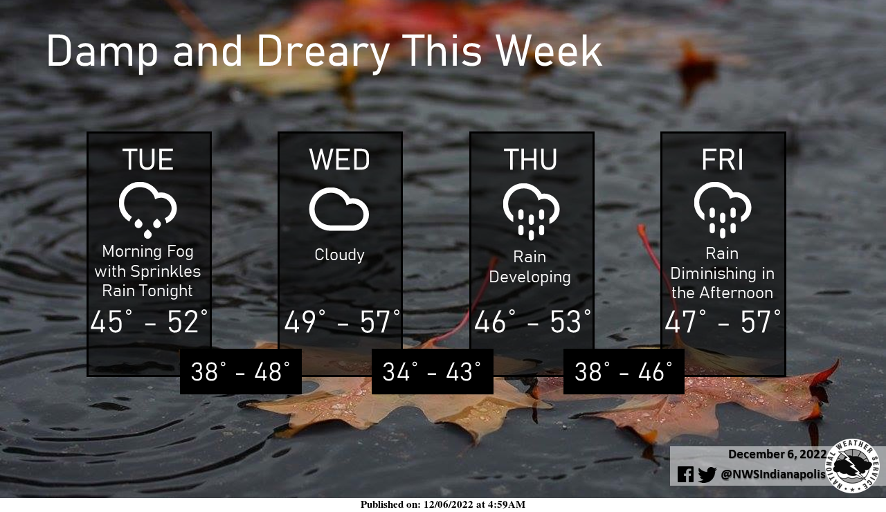
A frontal boundary will become nearly stationary along the Ohio River later today, with periodic threats for rain through the end of the work week.
The most widespread rainfall will come later today and tonight, then again Thursday afternoon into Friday.
Skies will remain cloudy for the rest of the week with highs ranging from the mid-40s to the mid-50s.
INDIANAPOLIS 7-DAY EXTENDED FORECAST
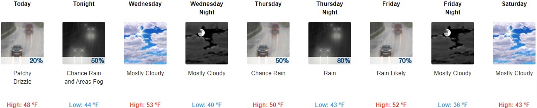
Today: Patchy drizzle before noon, then isolated showers after 4pm. Cloudy, with a high near 48. Light east-northeast wind. The chance of precipitation is 20%.
Tonight: Scattered showers before 10pm, then a chance of rain between 10pm and 1am. Areas of fog after 1am. Otherwise, cloudy, with a low of around 44. Light north wind. The chance of precipitation is 50%. New precipitation amounts to less than a tenth of an inch possible.
Wednesday: Mostly cloudy, with a high near 53. North wind around 6 mph.
Wednesday Night: Mostly cloudy, with a low of around 40. Northeast wind around 6 mph.
Thursday: A 50 percent chance of rain. Cloudy, with a high near 50. East wind 6 to 10 mph. New precipitation amounts between a tenth and a quarter of an inch possible.
Thursday Night: Rain. Low around 43. The chance of precipitation is 80%. New precipitation amounts between a tenth and a quarter of an inch possible.
Friday: Rain likely, mainly before 1pm. Mostly cloudy, with a high near 52. The chance of precipitation is 70%.
Friday Night: Mostly cloudy, with a low of around 36.
Saturday: Mostly cloudy, with a high near 43.
Saturday Night: Mostly cloudy, with a low of around 33.
Sunday: A slight chance of rain and snow. Partly sunny, with a high near 45. The chance of precipitation is 20%.
Sunday Night: A 30 percent chance of rain. Mostly cloudy, with a low of around 36.
Monday: A 40 percent chance of rain. Mostly cloudy, with a high near 48.
THE UNITED STATES OF AMERICA 3-DAY OUTLOOK


SOURCE: NWS Indianapolis.
Follow NWS Indianapolis on Twitter @NWSIndianapolis for the latest Indianapolis area weather news.