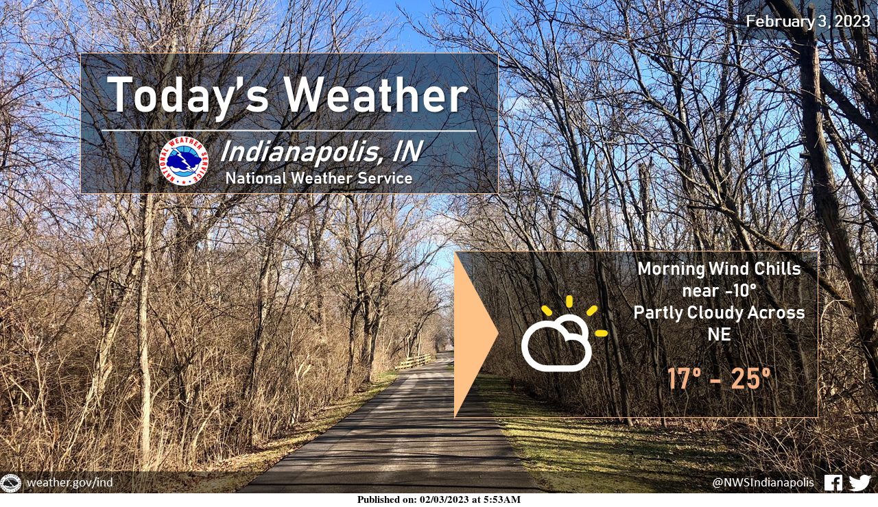
Well below normal temperatures to end the week with wind chills this morning dropping as low as -10.
Mostly sunny skies are expected across the SW half of central Indiana while the NE half will see increasing cloud coverage.
INDIANAPOLIS 7-DAY EXTENDED FORECAST
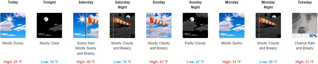
Today: Mostly sunny, with a high near 21. Wind chill values are as low as zero. Northwest wind 8 to 14 mph, with gusts as high as 21 mph.
Tonight: Mostly clear, with a low around 16. Northwest wind 5 to 10 mph becoming southeast after midnight.
Saturday: Sunny, with a high near 40. Breezy, with a south-southwest wind of 14 to 20 mph, with gusts as high as 29 mph.
Saturday Night: Mostly cloudy, with a low of around 35. Breezy, with a south-southwest wind of 22 to 24 mph, with gusts as high as 37 mph.
Sunday: Mostly cloudy, with a high near 47. Breezy, with a southwest wind of 17 to 23 mph, with gusts as high as 34 mph.
Sunday Night: Partly cloudy, with a low around 27.
Monday: Mostly sunny, with a high near 51.
Monday Night: Mostly cloudy, with a low of around 45. Breezy.
Tuesday: A 30 percent chance of rain. Mostly cloudy, with a high near 53. Breezy.
Tuesday Night: A 30 percent chance of rain, mainly after 1am. Partly cloudy, with a low of around 33.
Wednesday: A 30 percent chance of rain. Mostly sunny, with a high near 49.
Wednesday Night: A 40 percent chance of rain. Mostly cloudy, with a low of around 39.
Thursday: A 30 percent chance of rain. Mostly cloudy, with a high near 54.
THE UNITED STATES OF AMERICA 3-DAY OUTLOOK


SOURCE: NWS Indianapolis.
Follow NWS Indianapolis on Twitter @NWSIndianapolis for the latest Indianapolis area weather news.