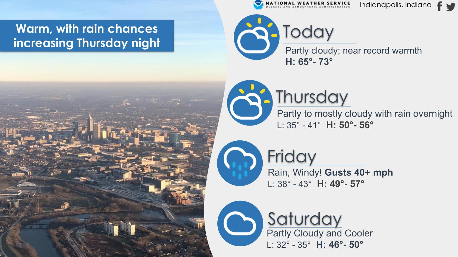
Near record high temperatures today as highs reach the mid 60s to mid 70s across Central Indiana!
Slightly cooler Thursday, then heavy rain and windy conditions arrive Thursday night into Friday.
INDIANAPOLIS 7-DAY EXTENDED FORECAST
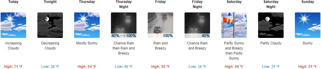
Today: Increasing clouds, with a high near 71. Southwest wind 7 to 13 mph.
Tonight: Mostly cloudy, then gradually becoming mostly clear, with a low around 38. Northwest wind 10 to 13 mph, with gusts as high as 20 mph.
Thursday: Mostly sunny, with a high near 54. Northeast wind 7 to 9 mph.
Thursday Night: Rain, mainly after 1am. Low around 40. Breezy, with an east wind 11 to 21 mph, with gusts as high as 31 mph. Chance of precipitation is 100%. New precipitation amounts between a quarter and half of an inch possible.
Friday: Rain. High near 55. Breezy, with an east northeast wind 21 to 28 mph becoming south in the afternoon. Winds could gust as high as 41 mph. Chance of precipitation is 100%. New precipitation amounts between 1 and 2 inches possible.
Friday Night: A chance of rain and thunderstorms before 10pm, then a chance of rain between 10pm and 1am. Mostly cloudy, with a low around 34. Breezy. Chance of precipitation is 40%.
Saturday: Partly sunny, with a high near 49. Breezy.
Saturday Night: Partly cloudy, with a low around 31.
Sunday: Sunny, with a high near 51.
Sunday Night: Partly cloudy, with a low around 35.
Monday: Mostly sunny, with a high near 59.
Monday Night: A 20 percent chance of rain. Mostly cloudy, with a low around 41.
Tuesday: Mostly cloudy, with a high near 55.
THE UNITED STATES OF AMERICA 3-DAY OUTLOOK


SOURCE: NWS Indianapolis.
Follow NWS Indianapolis on Twitter @NWSIndianapolis for the latest Indianapolis area weather news.