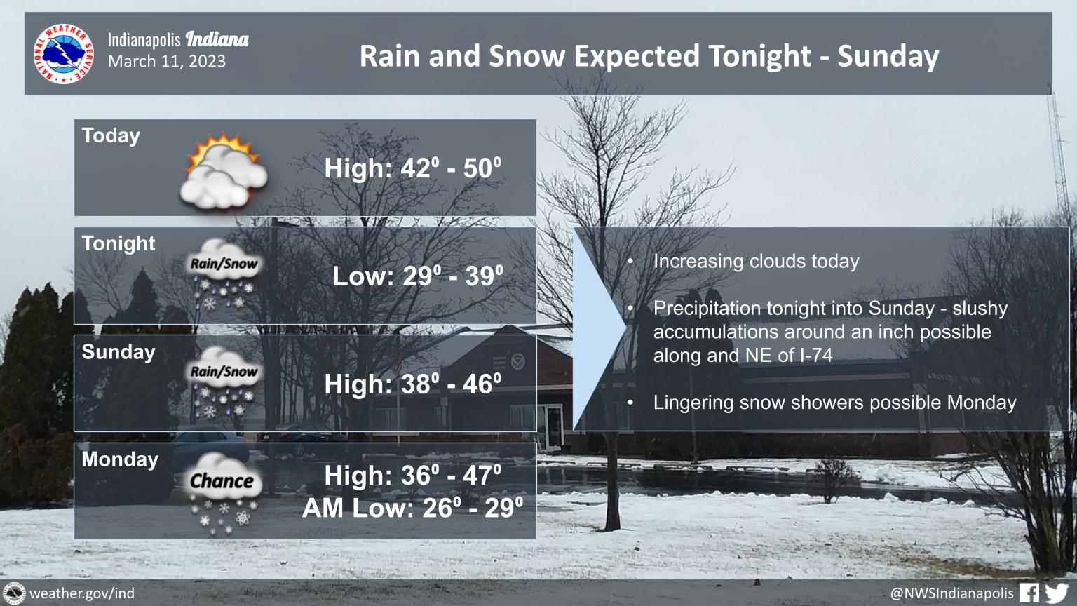
Precipitation is expected tonight into Sunday, with I-74 likely to be near the rain/snow line.
Slushy accumulations of around an inch are possible, primarily on grassy surfaces.
The warm ground will mitigate impacts.
Snow showers may linger into Monday.
INDIANAPOLIS 7-DAY EXTENDED FORECAST
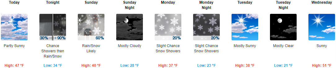
Today: Partly sunny, with a high near 47. East northeast wind 6 to 8 mph.
Tonight: Rain showers before 4am, then snow showers, possibly mixed with rain. Low around 34. East wind 9 to 14 mph, with gusts as high as 20 mph. Chance of precipitation is 90%. New snow accumulation of less than a half inch possible.
Sunday: Snow showers likely, possibly mixed with rain before 1pm, then a slight chance of rain showers. Mostly cloudy, with a high near 40. East wind 7 to 11 mph becoming northwest in the afternoon. Chance of precipitation is 60%. New snow accumulation of less than a half inch possible.
Sunday Night: Mostly cloudy, with a low around 28. West northwest wind 8 to 14 mph, with gusts as high as 22 mph.
Monday: A 20 percent chance of snow showers. Mostly cloudy, with a high near 37. West northwest wind 13 to 18 mph, with gusts as high as 28 mph.
Monday Night: A 20 percent chance of snow showers before 1am. Mostly cloudy, with a low around 23.
Tuesday: Mostly sunny, with a high near 38.
Tuesday Night: Mostly clear, with a low around 21.
Wednesday: Sunny, with a high near 51.
Wednesday Night: Mostly cloudy, with a low around 39.
Thursday: A 30 percent chance of showers. Mostly cloudy, with a high near 59.
Thursday Night: Showers likely. Cloudy, with a low around 43. Chance of precipitation is 60%.
Friday: Showers likely. Mostly cloudy, with a high near 51. Breezy. Chance of precipitation is 60%.
THE UNITED STATES OF AMERICA 3-DAY OUTLOOK


SOURCE: NWS Indianapolis.
Follow NWS Indianapolis on Twitter @NWSIndianapolis for the latest Indianapolis area weather news.