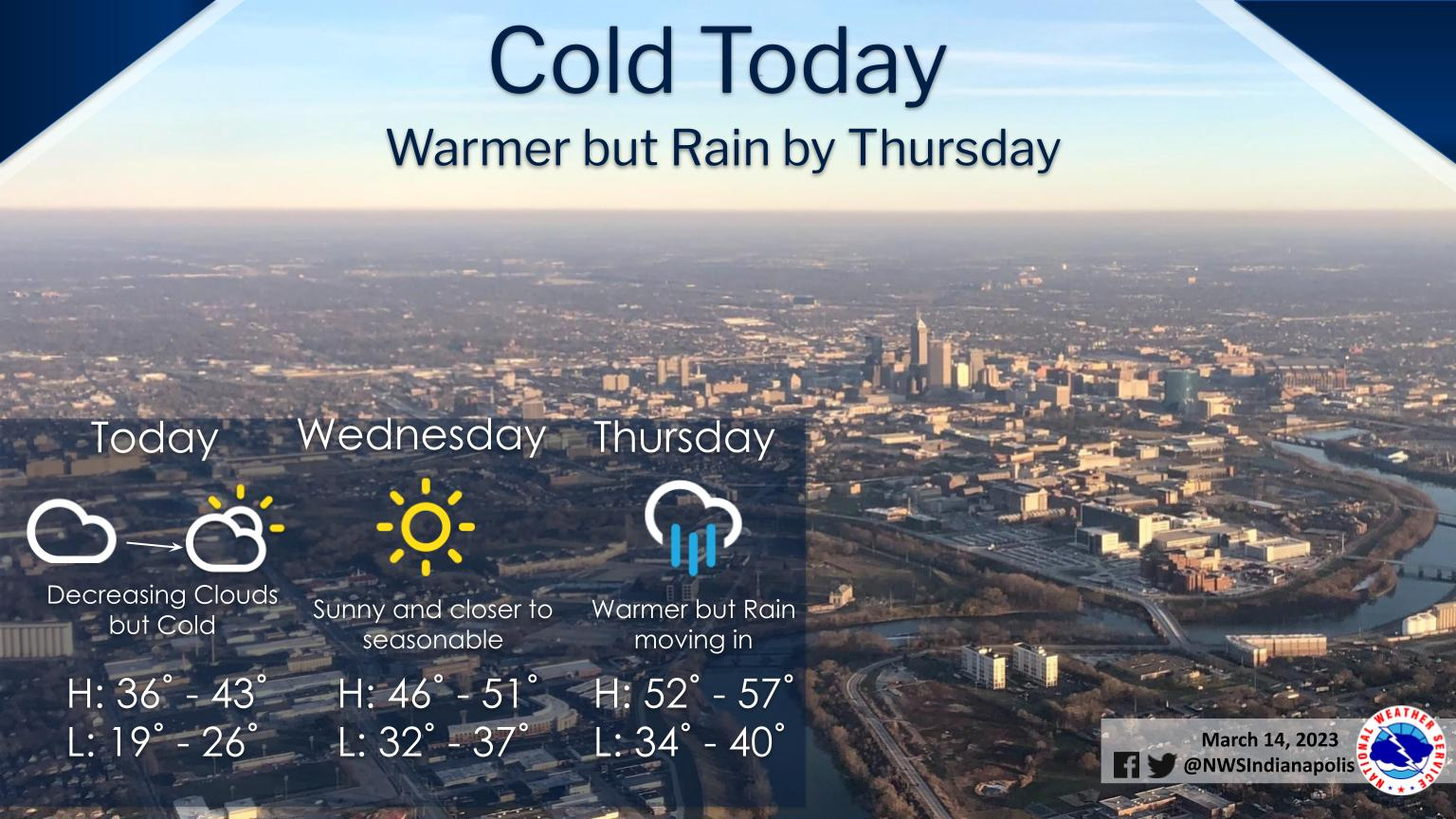
Today will be cold with a chance of flurries over eastern sections through midday.
Clouds will be decreasing during the afternoon from southwest to northeast but afternoon high temperatures will only reach the middle 30s to lower 40s which is over 10 degrees below normal for the middle of March.
High pressure will move off to the east late this week which will allow for southerly flow and a warmup but increasing chance of rain.
INDIANAPOLIS 7-DAY EXTENDED FORECAST
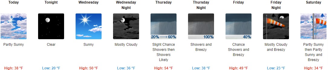
Today: Partly sunny, with a high near 38. Northwest wind around 14 mph, with gusts as high as 21 mph.
Tonight: Clear, with a low around 20. North northwest wind 5 to 8 mph becoming calm after midnight.
Wednesday: Sunny, with a high near 50. Calm wind becoming south southwest 5 to 9 mph in the morning.
Wednesday Night: Mostly cloudy, with a low around 36. South wind 8 to 10 mph, with gusts as high as 18 mph.
Thursday: Showers likely, mainly after 2pm. Mostly cloudy, with a high near 54. South wind 10 to 18 mph, with gusts as high as 28 mph. Chance of precipitation is 60%. New precipitation amounts of less than a tenth of an inch possible.
Thursday Night: Showers. Low around 38. Breezy. Chance of precipitation is 100%. New precipitation amounts between a quarter and half of an inch possible.
Friday: A 40 percent chance of showers before 2pm. Mostly cloudy, with a high near 49. Breezy.
Friday Night: Mostly cloudy, with a low around 23. Breezy.
Saturday: Partly sunny, with a high near 34. Breezy.
Saturday Night: Mostly cloudy, with a low around 23. Blustery.
Sunday: Mostly sunny, with a high near 39.
Sunday Night: Mostly clear, with a low around 24.
Monday: Sunny, with a high near 49.
THE UNITED STATES OF AMERICA 3-DAY OUTLOOK


SOURCE: NWS Indianapolis.
Follow NWS Indianapolis on Twitter @NWSIndianapolis for the latest Indianapolis area weather news.