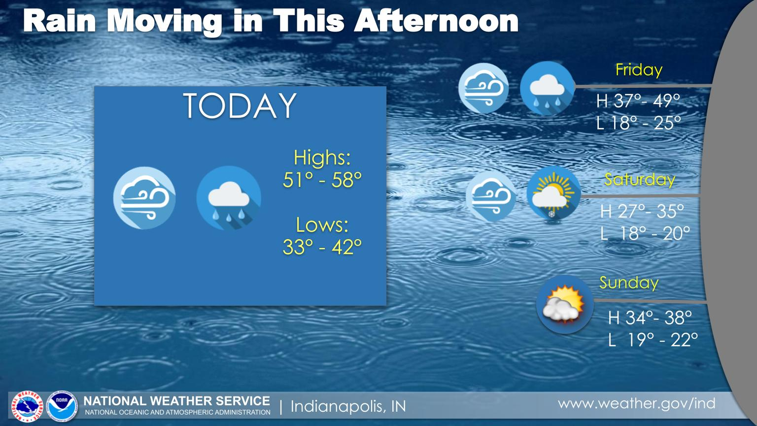
Today will be windy with gusts to 35 today and 40 mph tonight.
Rain will also be moving in and overspread central Indiana this afternoon.
A half an inch or more rainfall is expected.
Temperatures will be slightly above average for the middle of March.
However, much colder air is in on the way for the weekend.
INDIANAPOLIS 7-DAY EXTENDED FORECAST
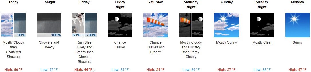
Today: Scattered showers after 3pm. Mostly cloudy, with a high near 56. South wind 10 to 17 mph, with gusts as high as 29 mph. Chance of precipitation is 30%.
Tonight: Showers. Low around 37. Breezy, with a south wind 18 to 22 mph, with gusts as high as 39 mph. Chance of precipitation is 100%. New precipitation amounts between a quarter and half of an inch possible.
Friday: Rain showers and sleet likely before 11am, then a chance of rain showers between 11am and 2pm. Cloudy, then gradually becoming mostly sunny, with a temperature falling to around 36 by 10am. Breezy, with a west northwest wind 17 to 21 mph, with gusts as high as 31 mph. Chance of precipitation is 60%. Little or no sleet accumulation expected.
Friday Night: A chance of flurries after 2am. Partly cloudy, with a low around 23. West northwest wind around 15 mph, with gusts as high as 23 mph.
Saturday: A chance of flurries before 2pm. Partly sunny, with a high near 31. Breezy, with a west wind 13 to 22 mph, with gusts as high as 32 mph.
Saturday Night: Partly cloudy, with a low around 20. Blustery.
Sunday: Mostly sunny, with a high near 37.
Sunday Night: Mostly clear, with a low around 22.
Monday: Sunny, with a high near 47.
Monday Night: Mostly clear, with a low around 27.
Tuesday: Mostly sunny, with a high near 54.
Tuesday Night: Partly cloudy, with a low around 34.
Wednesday: A 40 percent chance of showers. Partly sunny, with a high near 57.
THE UNITED STATES OF AMERICA 3-DAY OUTLOOK


SOURCE: NWS Indianapolis.
Follow NWS Indianapolis on Twitter @NWSIndianapolis for the latest Indianapolis area weather news.