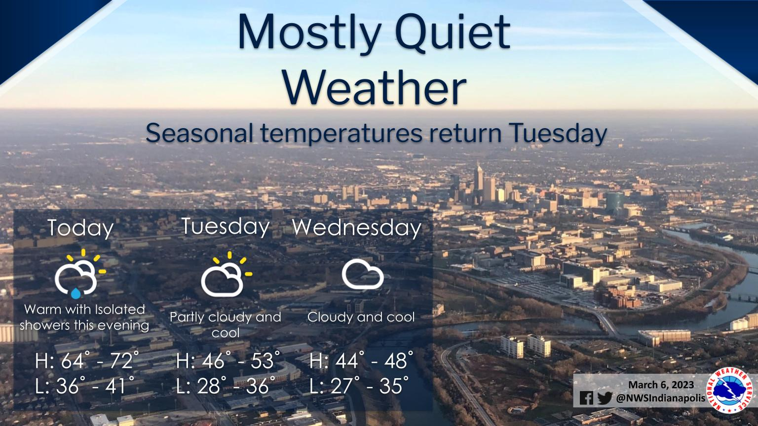
Clouds will increase through the day with isolated showers possible this evening as a cold front moves in.
Expect warm temperatures today with highs in the mid 60s to low 70s before returning to near seasonal Tuesday.
INDIANAPOLIS 7-DAY EXTENDED FORECAST
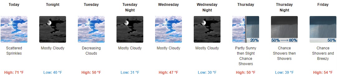
Today: Scattered sprinkles after 2pm. Partly sunny, with a high near 71. South southwest wind 14 to 18 mph, with gusts as high as 28 mph.
Tonight: Mostly cloudy, with a low around 40. Northwest wind 10 to 15 mph, with gusts as high as 23 mph.
Tuesday: Mostly cloudy, then gradually becoming sunny, with a high near 50. Northeast wind around 14 mph, with gusts as high as 22 mph.
Tuesday Night: Mostly cloudy, with a low around 31. East northeast wind around 14 mph, with gusts as high as 22 mph.
Wednesday: Mostly cloudy, with a high near 47. East northeast wind 11 to 13 mph, with gusts as high as 20 mph.
Wednesday Night: Mostly cloudy, with a low around 30.
Thursday: A 20 percent chance of showers after 1pm. Partly sunny, with a high near 50.
Thursday Night: Showers, mainly after 1am. Low around 39. Chance of precipitation is 80%.
Friday: A 50 percent chance of showers. Mostly cloudy, with a high near 54. Breezy.
Friday Night: A chance of rain showers before 1am, then a chance of rain and snow showers. Mostly cloudy, with a low around 31. Breezy. Chance of precipitation is 30%.
Saturday: Mostly cloudy, with a high near 43.
Saturday Night: Mostly cloudy, with a low around 30.
Sunday: A 20 percent chance of showers. Partly sunny, with a high near 43.
THE UNITED STATES OF AMERICA 3-DAY OUTLOOK


SOURCE: NWS Indianapolis.
Follow NWS Indianapolis on Twitter @NWSIndianapolis for the latest Indianapolis area weather news.