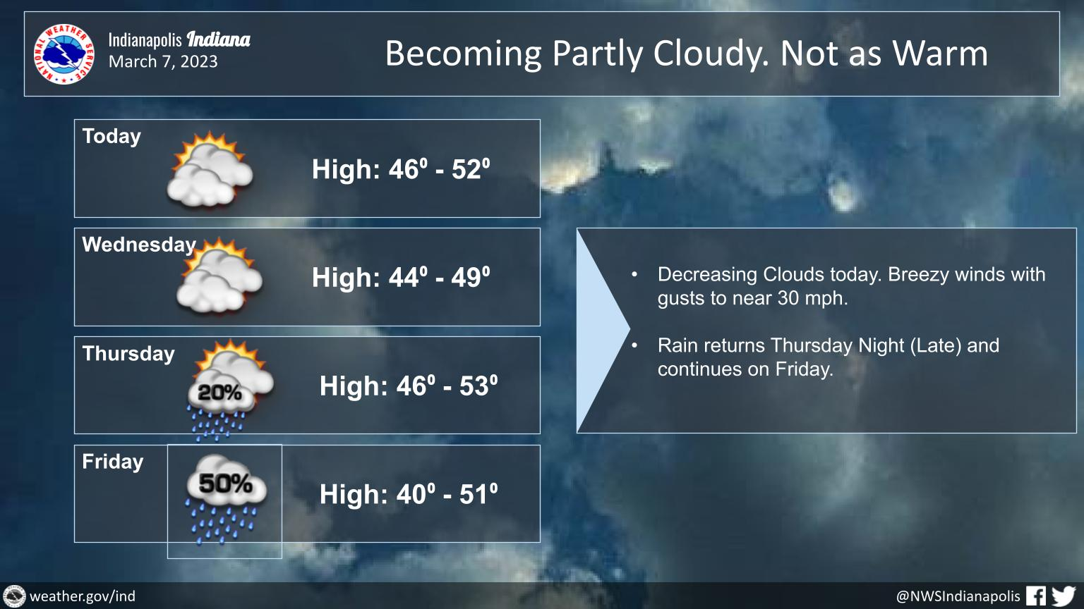
Dry but cooler weather is expected today and Wednesday.
It will be breezy today with gusts to 30 mph possible.
Chances for rain will return on late Thursday Night.
INDIANAPOLIS 7-DAY EXTENDED FORECAST
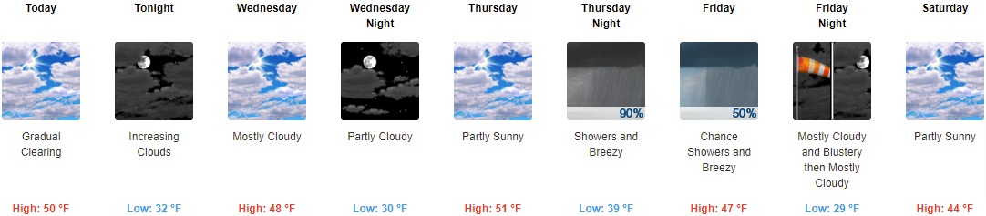
Today: Cloudy early, then gradual clearing, with a high near 50. Northeast wind around 14 mph, with gusts as high as 20 mph.
Tonight: Increasing clouds, with a low around 32. East northeast wind around 14 mph, with gusts as high as 22 mph.
Wednesday: Mostly cloudy, with a high near 48. East northeast wind 11 to 13 mph, with gusts as high as 18 mph.
Wednesday Night: Partly cloudy, with a low around 30. East wind 11 to 14 mph, with gusts as high as 22 mph.
Thursday: Partly sunny, with a high near 51. East wind around 14 mph, with gusts as high as 21 mph.
Thursday Night: Showers, mainly after 10pm. Low around 39. Breezy. Chance of precipitation is 90%. New precipitation amounts between a tenth and quarter of an inch possible.
Friday: A 50 percent chance of showers. Mostly cloudy, with a high near 47. Breezy.
Friday Night: Mostly cloudy, with a low around 29. Blustery.
Saturday: Partly sunny, with a high near 44.
Saturday Night: A slight chance of rain and snow showers. Mostly cloudy, with a low around 31. Chance of precipitation is 20%.
Sunday: A 20 percent chance of showers. Mostly cloudy, with a high near 45.
Sunday Night: Mostly cloudy, with a low around 31.
Monday: Partly sunny, with a high near 46.
THE UNITED STATES OF AMERICA 3-DAY OUTLOOK


SOURCE: NWS Indianapolis.
Follow NWS Indianapolis on Twitter @NWSIndianapolis for the latest Indianapolis area weather news.