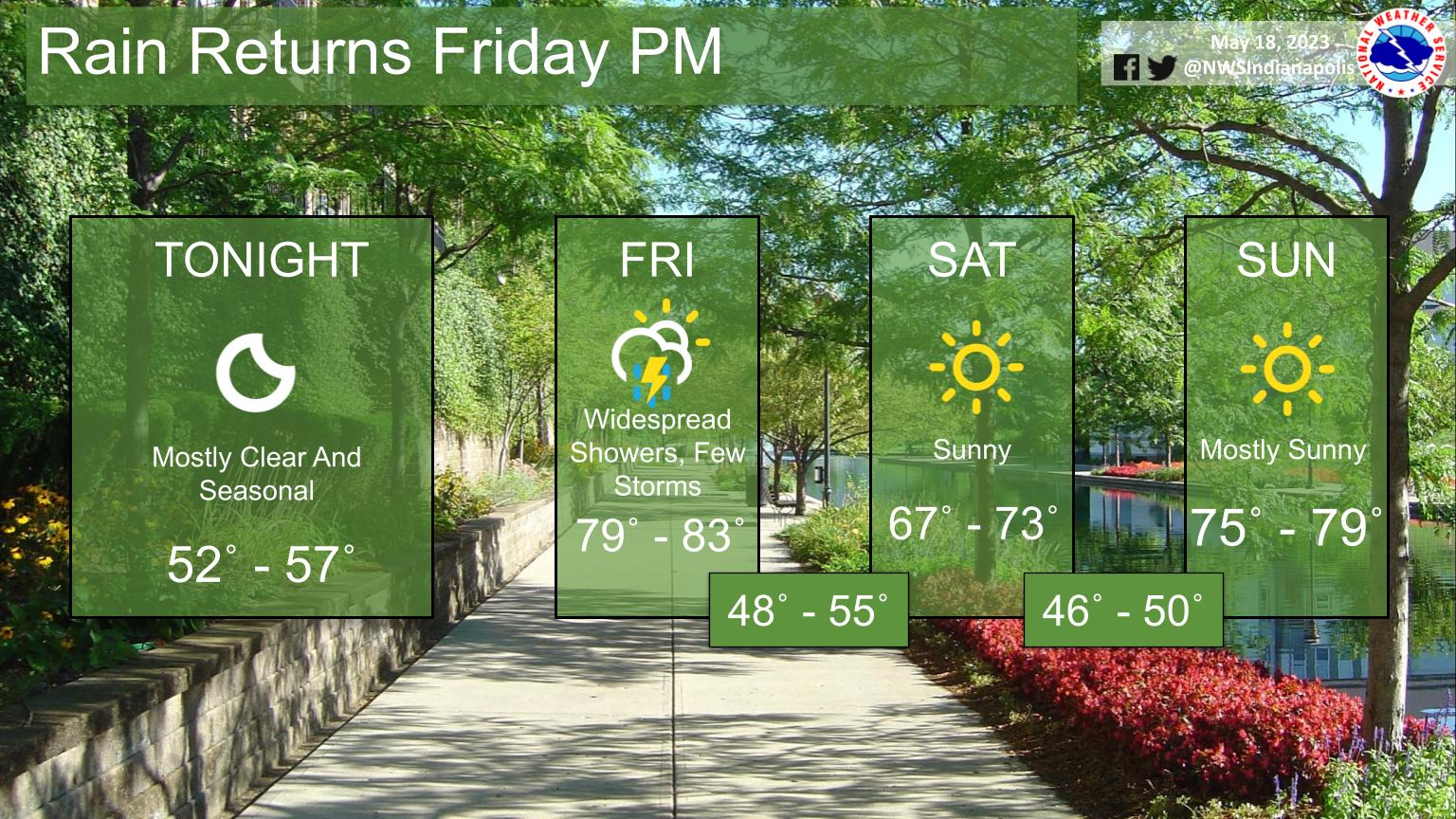
Expect widespread rain late Friday as a cold front moves through.
Highs will be warmer than normal Friday due to increasing SW surface flow.
Cold air advection behind the front will lead to beautiful weather conditions for the weekend!
INDIANAPOLIS 7-DAY EXTENDED FORECAST
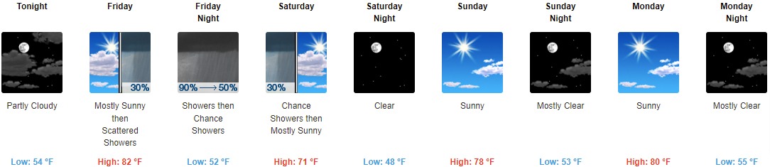
Tonight: Partly cloudy, with a low around 54. South wind around 6 mph.
Friday: Scattered showers, mainly after 5pm. Mostly sunny, with a high near 82. Southwest wind 7 to 10 mph. Chance of precipitation is 30%.
Friday Night: Showers and possibly a thunderstorm before 2am, then a chance of showers and thunderstorms, mainly after 3am. Low around 52. North wind around 11 mph. Chance of precipitation is 90%. New rainfall amounts between a tenth and quarter of an inch, except higher amounts possible in thunderstorms.
Saturday: A 30 percent chance of showers before 8am. Mostly sunny, with a high near 71. North wind around 11 mph, with gusts as high as 18 mph.
Saturday Night: Clear, with a low around 48. North wind 7 to 10 mph.
Sunday: Sunny, with a high near 78.
Sunday Night: Mostly clear, with a low around 53.
Monday: Sunny, with a high near 80.
Monday Night: Mostly clear, with a low around 55.
Tuesday: Sunny, with a high near 83.
Tuesday Night: Mostly clear, with a low around 59.
Wednesday: Sunny, with a high near 84.
Wednesday Night: Mostly clear, with a low around 59.
Thursday: Sunny, with a high near 85.
THE UNITED STATES OF AMERICA 3-DAY OUTLOOK


SOURCE: NWS Indianapolis.
Follow NWS Indianapolis on Twitter @NWSIndianapolis for the latest Indianapolis area weather news.