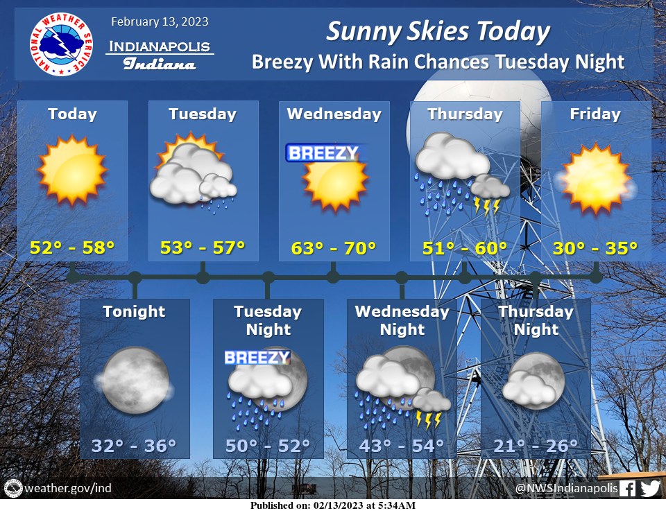
High clouds will clear out this morning leading to another sunny and warm day across central Indiana.
Rain chances arrive late Tuesday with winds up to 40 mph during the overnight hours.
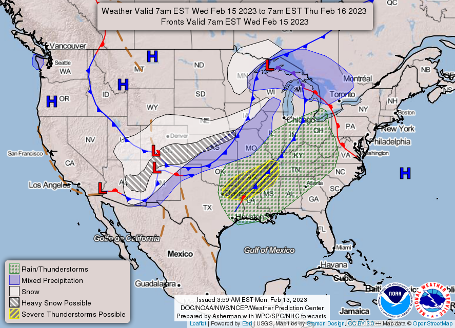
Very warm Wednesday with rain/storm chances going into Thursday. A few strong storms possible.
INDIANAPOLIS 7-DAY EXTENDED FORECAST
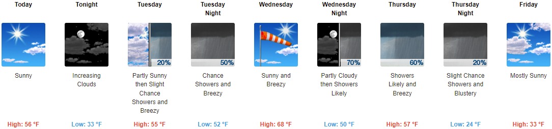
Today: Sunny, with a high near 56. West northwest wind 7 to 11 mph, with gusts as high as 20 mph.
Tonight: Increasing clouds, with a low around 33. West northwest wind around 6 mph becoming calm.
Tuesday: A 20 percent chance of showers after 1pm. Increasing clouds, with a high near 55. Breezy, with a southeast wind 10 to 20 mph, with gusts as high as 29 mph.
Tuesday Night: A 50 percent chance of showers before 1am. Mostly cloudy, with a low around 52. Breezy, with a south wind 24 to 28 mph, with gusts as high as 36 mph. New precipitation amounts of less than a tenth of an inch possible.
Wednesday: Sunny, with a high near 68. Breezy, with a southwest wind 18 to 26 mph, with gusts as high as 32 mph.
Wednesday Night: Showers likely and possibly a thunderstorm, mainly after 4am. Mostly cloudy, with a low around 50. Chance of precipitation is 70%. New rainfall amounts between a tenth and quarter of an inch, except higher amounts possible in thunderstorms.
Thursday: Showers likely and possibly a thunderstorm before 1pm, then a chance of showers and thunderstorms after 1pm. Mostly cloudy, with a high near 57. Breezy. Chance of precipitation is 60%.
Thursday Night: A 20 percent chance of showers before 1am. Mostly cloudy, with a low around 24. Blustery.
Friday: Mostly sunny, with a high near 33.
Friday Night: Clear, with a low around 22.
Saturday: Sunny, with a high near 46.
Saturday Night: Partly cloudy, with a low around 34.
Sunday: Mostly sunny, with a high near 52. Breezy.
THE UNITED STATES OF AMERICA 3-DAY OUTLOOK
SOURCE: NWS Indianapolis.
Follow NWS Indianapolis on Twitter @NWSIndianapolis for the latest Indianapolis area weather news.