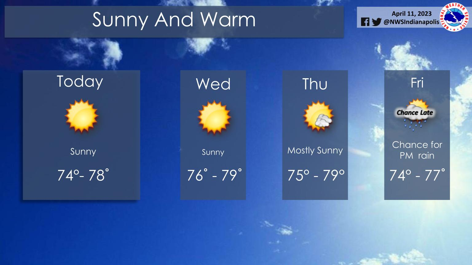
Pleasant, dry weather will continue through Thursday with warm temperatures.
Clouds will increase Thursday night, followed by rain chances on Friday afternoon and Saturday.
INDIANAPOLIS 7-DAY EXTENDED FORECAST
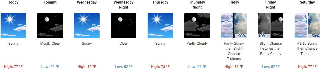
Today: Sunny, with a high near 77. Light south wind becoming west southwest 5 to 10 mph in the morning.
Tonight: Mostly clear, with a low around 50. Southwest wind around 9 mph.
Wednesday: Sunny, with a high near 79. West southwest wind 10 to 14 mph, with gusts as high as 21 mph.
Wednesday Night: Clear, with a low around 52. Southwest wind 9 to 11 mph.
Thursday: Sunny, with a high near 78. South southwest wind 7 to 9 mph.
Thursday Night: Partly cloudy, with a low around 54.
Friday: A 20 percent chance of showers and thunderstorms after 2pm. Partly sunny, with a high near 76.
Friday Night: A 10 percent chance of showers and thunderstorms before 8pm. Partly cloudy, with a low around 57.
Saturday: A 50 percent chance of showers and thunderstorms after 2pm. Partly sunny, with a high near 77.
Saturday Night: A chance of showers and thunderstorms, then showers likely after 8pm. Mostly cloudy, with a low around 48. Chance of precipitation is 60%.
Sunday: A 30 percent chance of showers. Mostly sunny, with a high near 60. Breezy.
Sunday Night: A 20 percent chance of showers. Partly cloudy, with a low around 43.
Monday: Mostly sunny, with a high near 58. Breezy.
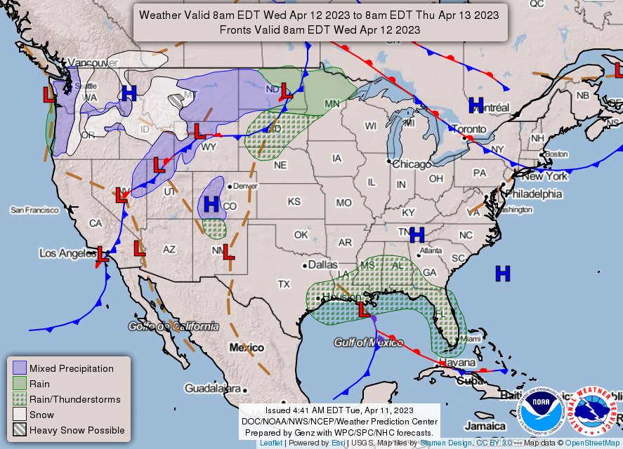
THE UNITED STATES OF AMERICA 3-DAY OUTLOOK

SOURCE: NWS Indianapolis.
Follow NWS Indianapolis on Twitter @NWSIndianapolis for the latest Indianapolis area weather news.