Santa will be left wondering where the snow and seasonable temperatures have gone as near to record warmth spreads over central Indiana.
The weather will also be unsettled with widespread rain this morning, Sunday night, and again early next week.
Thunderstorms are possible overnight Sunday night.
Flooding will be possible by Tuesday or Tuesday night.
INDIANAPOLIS 7-DAY EXTENDED FORECAST

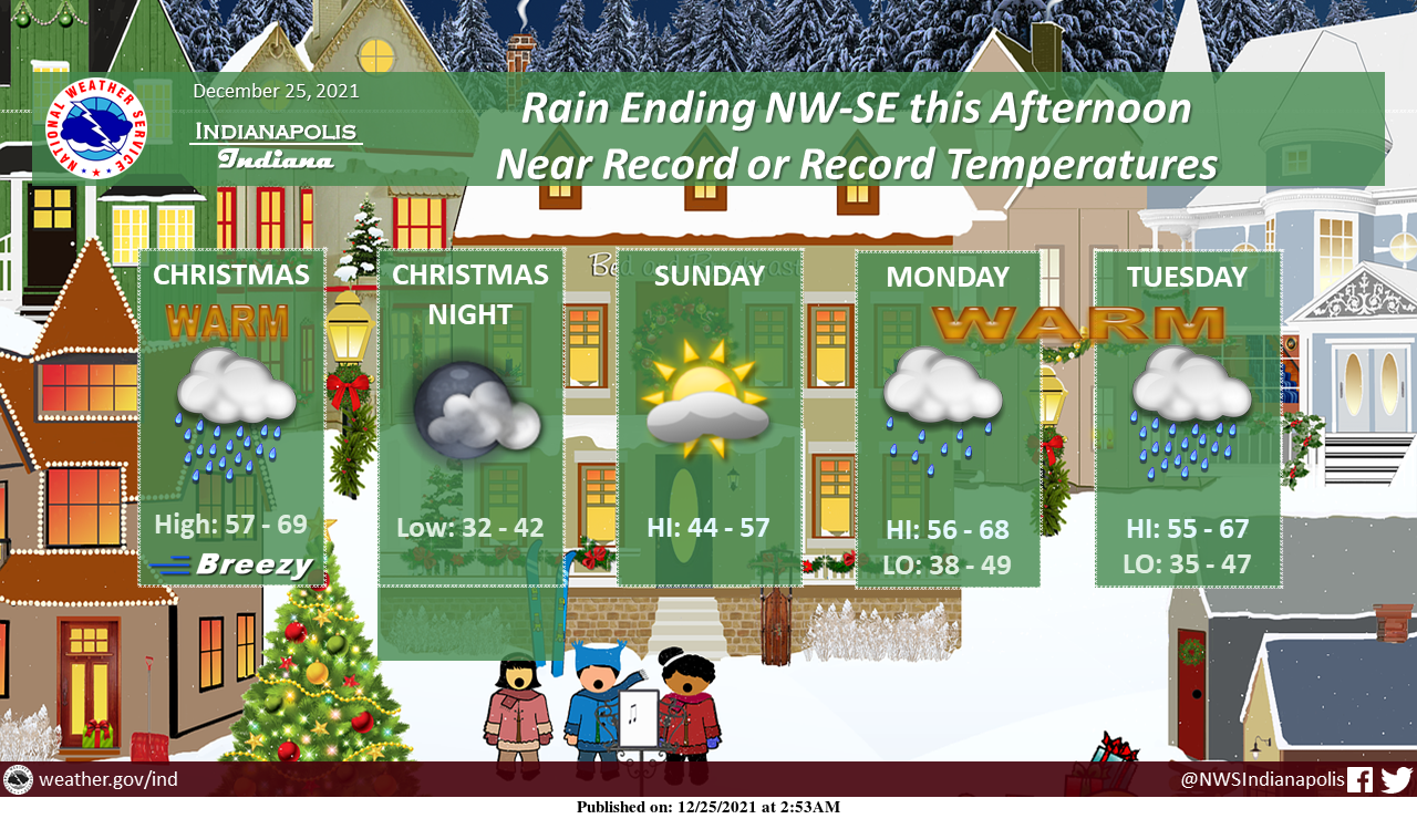
Christmas Day: Showers, mainly before noon. Temperature falling to around 55 by 5pm. West southwest wind 8 to 11 mph becoming north northwest in the afternoon. Winds could gust as high as 22 mph. The chance of precipitation is 80%. New precipitation amounts between a quarter and half of an inch possible.
Saturday Night: Mostly cloudy, with a low around 35. West northwest wind around 6 mph.
Sunday: Partly sunny, with a high near 49. Calm wind becoming southeast 5 to 7 mph in the afternoon.
Sunday Night: Rain likely before 1am, then rain and possibly a thunderstorm between 1am and 4am, then rain after 4am. Low around 44. East southeast wind 6 to 10 mph, with gusts as high as 20 mph. The chance of precipitation is 90%. New rainfall amounts between a quarter and half of an inch possible.
Monday: A chance of rain and thunderstorms. Mostly cloudy, with a high near 62. The chance of precipitation is 30%.
Monday Night: A 40 percent chance of rain. Mostly cloudy, with a low around 44.
Tuesday: Rain. High near 56. The chance of precipitation is 100%.
Tuesday Night: Rain and possibly a thunderstorm before 1am, then a chance of rain. Low around 41. The chance of precipitation is 80%.
Wednesday: A 30 percent chance of rain, mainly before 1pm. Mostly sunny, with a high near 49.
Wednesday Night: Partly cloudy, with a low around 27.
Thursday: Sunny, with a high near 41.
Thursday Night: Partly cloudy, with a low around 29.
Friday: Sunny, with a high near 44.
THE UNITED STATES OF AMERICA 3-DAY OUTLOOK


SOURCE: NWS Indianapolis.
Follow NWS Indianapolis on Twitter @NWSIndianapolis for the latest Indianapolis area weather news.