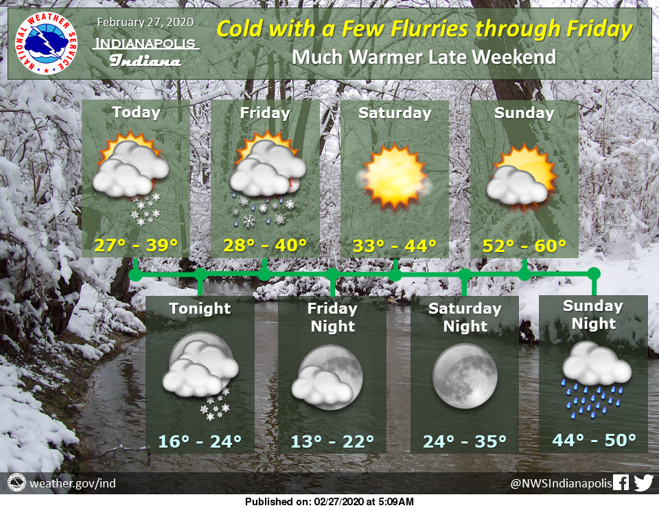
Skies will remain mostly cloudy through Friday with periodic flurries and light snow showers, especially later this afternoon, tonight and Friday. A few locations may see the ground whiten under heavier snow showers but much of the area will see no accumulation.
High pressure will bring clearing skies and warming temperatures this weekend.
A frontal boundary will become nearly stationary over the area for early next week, with an increased potential for heavy rainfall and a greater risk for flooding by the middle of next week.
Via https://www.weather.gov/ind/weatherstory.
AROUND TWITTER
With pavement temps lowered overnight, streets were more susceptible to icing and drifting.
Build extra time into your morning commute so you don’t feel rushed!
Take it slow out there, Indy, and #DontCrowdThePlow when you see our drivers out salting/plowing.
(📸: W 21st Street) pic.twitter.com/MaNQQ5TD7M— Indy Snow Force (@IndySnowForce) February 27, 2020
The sun is up! Here's what's ahead in our Thursday forecast. #INwx pic.twitter.com/c3iM8ymNot
— Kyle Mounce (@kylemounce) February 27, 2020
Scattered light snow showers and flurries are possible at times through Friday. Dry and warmer this weekend. #INwx #indy pic.twitter.com/IDwh9m7jI6
— NWS Indianapolis (@NWSIndianapolis) February 27, 2020