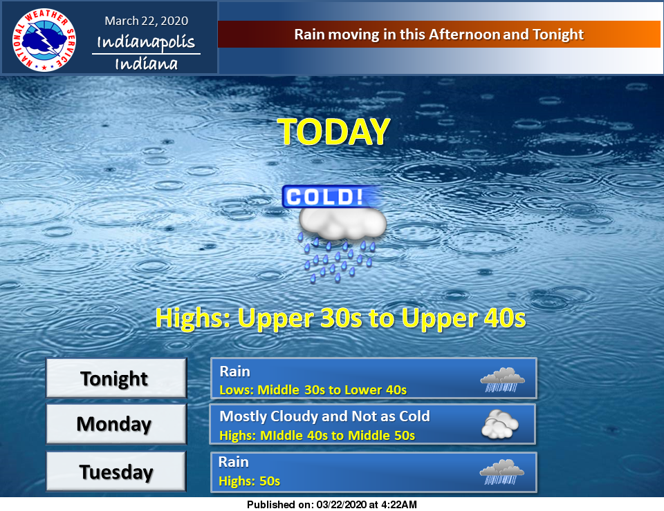
Rain will move in this afternoon and tonight.
Meanwhile, more rain and a warming trend is on tap next week.
Via NWS Indianapolis. Follow them on Twitter @NWSIndianapolis for the latest Indianapolis area weather news.
AROUND TWITTER
Rain chances return later today, keeping highs in the 40s. #INwx pic.twitter.com/Ef0LPybFHW
— Kyle Mounce (@kylemounce) March 22, 2020
Day Planner >> Chilly start to the day… Clouds increase this AM and showers arrive this afternoon. Some wet snowflakes will mix in with rain for northern parts of the area. #INwx @FOX59 @theWXauthority #FOX59morning pic.twitter.com/DppWMkoqza
— Amber Hardwick (@AHardwickWx) March 22, 2020
Seasonal Snowfall >> Still @ 16.2" for Indianapolis… 9" below average to date. Minor snow accumulation possible in northern IN tonight. Much of central IN will see only see rain. NW & northernmost counties have the best chance of rain-snow mix. #INwx @FOX59 @theWXauthority pic.twitter.com/oCQHJxwnx7
— Amber Hardwick (@AHardwickWx) March 22, 2020
MARCH PRECIP >> Above average to date in Indianapolis for the total precipitation for the month! #Indy has had 3.22" of rain, +0.93" above normal! We are tracking more rain chances for this afternoon and tonight… #INwx @FOX59 @theWXauthority pic.twitter.com/lVV469vVV9
— Amber Hardwick (@AHardwickWx) March 22, 2020
https://twitter.com/stephmeadwx/status/1241690296611733504