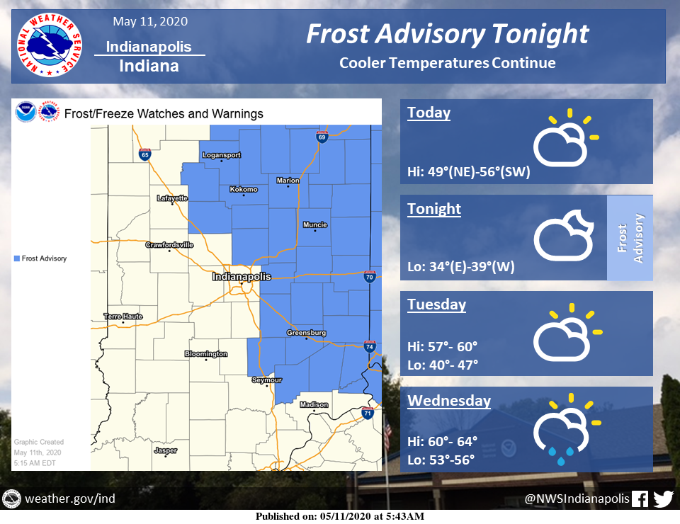
Cool temperatures will continue to start the workweek.
Today will be cloudy, with pockets of sunshine and highs in the low 50s.
Tonight, temperatures are expected to drop into the mid-30s.
A Frost Advisory has been issued for counties east of I-65 from 2 AM to 8 AM tonight, where temperatures are expected to be coldest. Unprotected vegetation can be damaged if exposed to frost, so take precautions where needed.
Temperatures look to warm-up starting Thursday, along with increased rain chances.
Via NWS Indianapolis. Follow them on Twitter @NWSIndianapolis for the latest Indianapolis area weather news.
AROUND TWITTER
It will be unusually cold again today, but it will start to balance out by mid-week. https://t.co/Mh5m9Zi95s #INwx #FOX59Morning
— FOX59 News (@FOX59) May 11, 2020
It's the start of another work week! Here's a check of your Monday forecast. #INwx pic.twitter.com/8VAH6Lz4VW
— Kyle Mounce (@kylemounce) May 11, 2020
https://twitter.com/StarDerryWX/status/1259777158718906368
A cool start to the week with highs in the lower 50s and a mostly cloudy sky. We have 70s and 80s in the extended so it does get better by the end of the week! @WISH_TV #INwx #Indy pic.twitter.com/P6hxXPwo32
— Stephanie Mead (@stephmeadwx) May 11, 2020
https://twitter.com/LindseyWTHR13/status/1259736553649254400