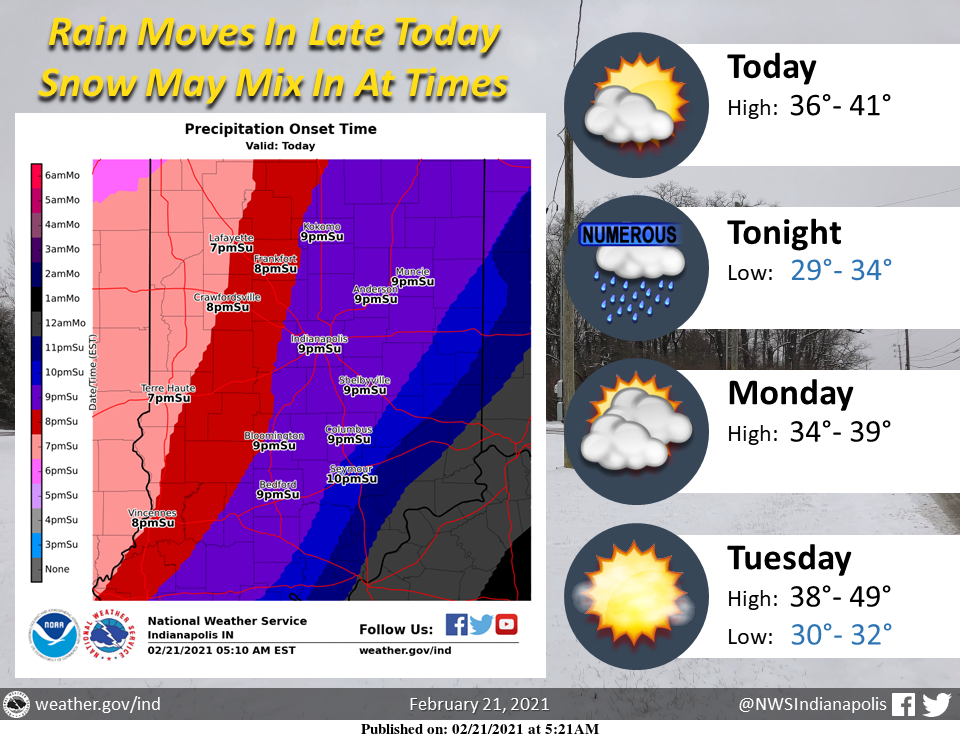
Widespread rain will move in late this evening with brief periods of snow mixing in across north-central Indiana.
Rainfall amounts of around 1/4 of an inch expected.
Isolated slick spots are likely as rain falls on frozen ground.
Some places across north-central Indiana could see a quick half-inch of snow accumulation.
Precipitation will generally come to an end by Monday morning with some drizzle possible through the morning hours.
Going into later this week, the warming trend continues with some spots hitting 50 by Wednesday.
IND ended the consecutive-days-below-freezing streak at 14 days on Saturday, a once-in-5-yrs occurrence.
Following are still active…
Sub-40F, 30 days (12th-longest)
Sub-50F, 55 days (14th-longest)
(1940, 1978 had no 50s Jan-Feb)https://t.co/VycOcORr2q #INwx— NWS Indianapolis (@NWSIndianapolis) February 21, 2021
THE UNITED STATES OF AMERICA 3-DAY OUTLOOK


SOURCE: NWS Indianapolis.
Follow NWS Indianapolis on Twitter @NWSIndianapolis for the latest Indianapolis area weather news.