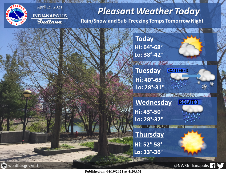
Mostly sunny to partly cloudy skies today with temperatures climbing into the mid to upper 60s.
Rain will move in tomorrow evening before transitioning into snow late in the evening and continue through the night.
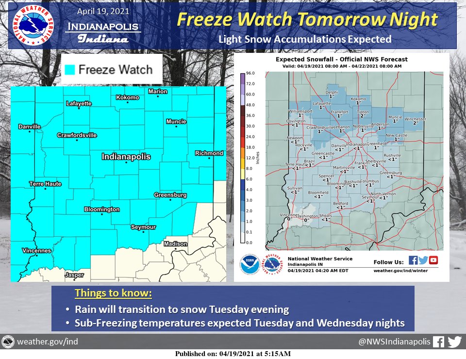
Sub-freezing temperatures expected Tuesday and Wednesday nights.
Freeze Watch tomorrow night with temperatures in the upper 20s to low 30s.
Ahead of that cold, the rain will transition to snow Tuesday evening before becoming mostly snow after 8 PM.
Light snow accumulations expected during periods of heavier snow with any snow melting by early Wednesday.
Best chances for accumulations of snow across north-central Indiana.
THE UNITED STATES OF AMERICA 3-DAY OUTLOOK


SOURCE: NWS Indianapolis.
Follow NWS Indianapolis on Twitter @NWSIndianapolis for the latest Indianapolis area weather news.