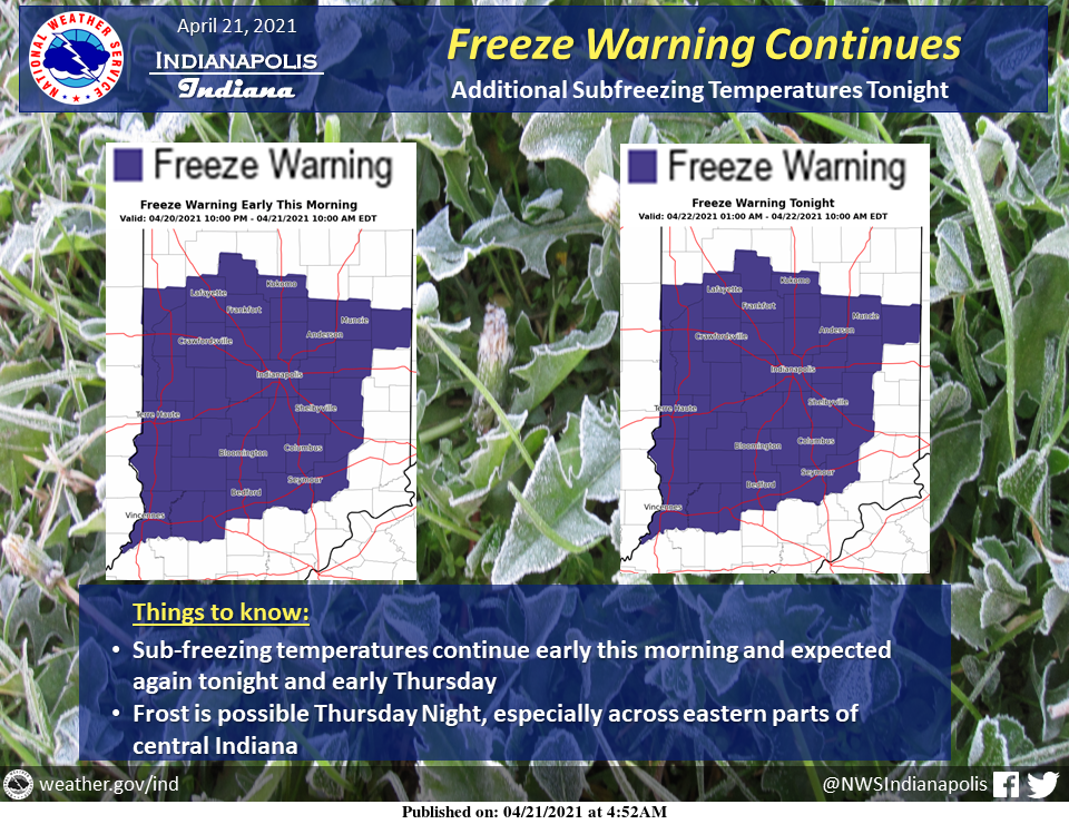
A Freeze Warning continues through 10 AM this morning, then returns again for tonight and early Thursday morning.
Temperatures will be in the mid and upper 20s through daybreak.
Another night of sub-freezing temperatures will occur tonight as lows fall into the upper 20s and lower 30s.
Frost is possible on Thursday night as well, but temperatures will remain above freezing in the mid to upper 30s.
INDIANAPOLIS 7-DAY OUTLOOK
Today: A slight chance of rain and snow showers before 1 pm, then rain showers likely. Some thunder is also possible. Partly sunny, with a high near 46. West wind 5 to 11 mph, with gusts as high as 20 mph. The chance of precipitation is 60%. Little or no snow accumulation expected.
Tonight: Scattered showers and thunderstorms before 8 pm, then isolated showers between 8 pm and 9 pm. Widespread frost after 3 am. Otherwise, partly cloudy, with a low around 31. West wind 5 to 10 mph. The chance of precipitation is 30%.
Thursday: Widespread frost before 9 am. Otherwise, sunny, with a high near 54. West wind 6 to 11 mph.
Thursday Night: Mostly clear, with a low around 36. South southwest wind 5 to 8 mph.
Friday: Partly sunny, with a high near 61. South wind 6 to 11 mph.
Friday Night: Showers likely, mainly after 2 am. Mostly cloudy, with a low around 47. The chance of precipitation is 60%. New precipitation amounts between a tenth and quarter of an inch possible.
Saturday: Showers likely, mainly before 2 pm. Mostly cloudy, with a high near 58. The chance of precipitation is 70%.
Saturday Night: A 30 percent chance of showers before 8 pm. Partly cloudy, with a low around 42.
Sunday: Mostly sunny, with a high near 62.
Sunday Night: Partly cloudy, with a low around 43.
Monday: Sunny, with a high near 74.
Monday Night: Partly cloudy, with a low around 55.
Tuesday: Mostly sunny, with a high near 80.
THE UNITED STATES OF AMERICA 3-DAY OUTLOOK


SOURCE: NWS Indianapolis.
Follow NWS Indianapolis on Twitter @NWSIndianapolis for the latest Indianapolis area weather news.